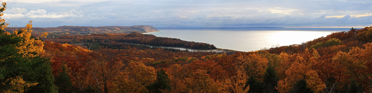
Marquette Michigan – August 17 to 22, 2014

It was an easy 1 hour 45 minute drive north from Fayette State Park to Marquette and the Tourist Park Campground. We settled into our campsite just in time for lunch.
This was out second time staying at the Marquette Tourist Park. On our previous visit we only spent 3 nights here because we could not find much information about the campground and we were not sure how we would like camping inside the city limits of the largest town in the Upper Peninsula. We squeezed as much as we could into those 3 days and ended up having a great time. With everything that there is to do in and around Marquette we wished we had planned to stay longer. This time we made it our main stop of the trip planning for 5 nights.
Marquette Tourist Park Camping
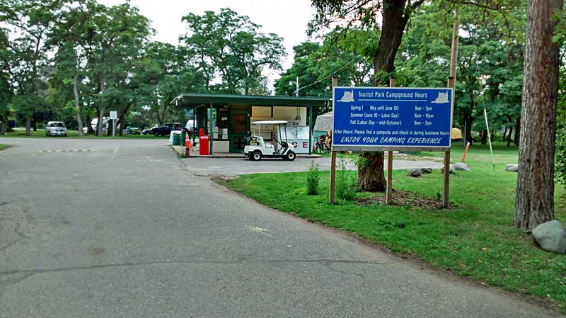
The Tourist Park Campground entrance.
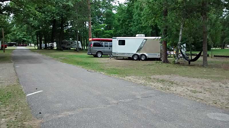
We stayed in site 97 which is the same place we were at the last time we were here. It is a nice big campsite, but there is not much privacy.
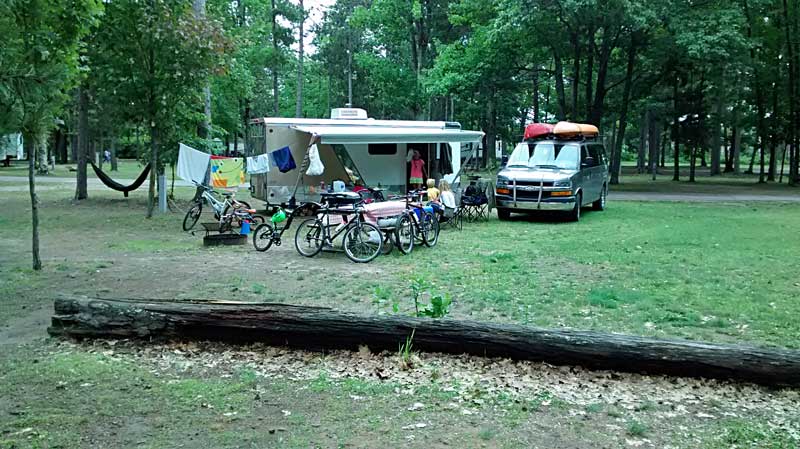
We picked this site again because we liked that it backed up to the playground area. This way we could sit by our campfire at night and still watch the kids playing. 10 years ago this would have been the last place we would have wanted to be. It is kind of funny how much your perspective changes after you have kids of your own.
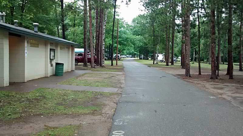
The bathhouse was close, but not too close to our site.
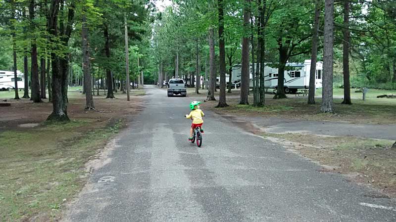
We made a lot of trips around the loop on bikes.

Since we were here last they made a small beach area on the Dead River Pond. We didn’t have any beach weather while we were here. However, even if we did, I think we would have driven to one of the Lake Superior beaches.
The lifeguard looked pretty board sitting out there all week.
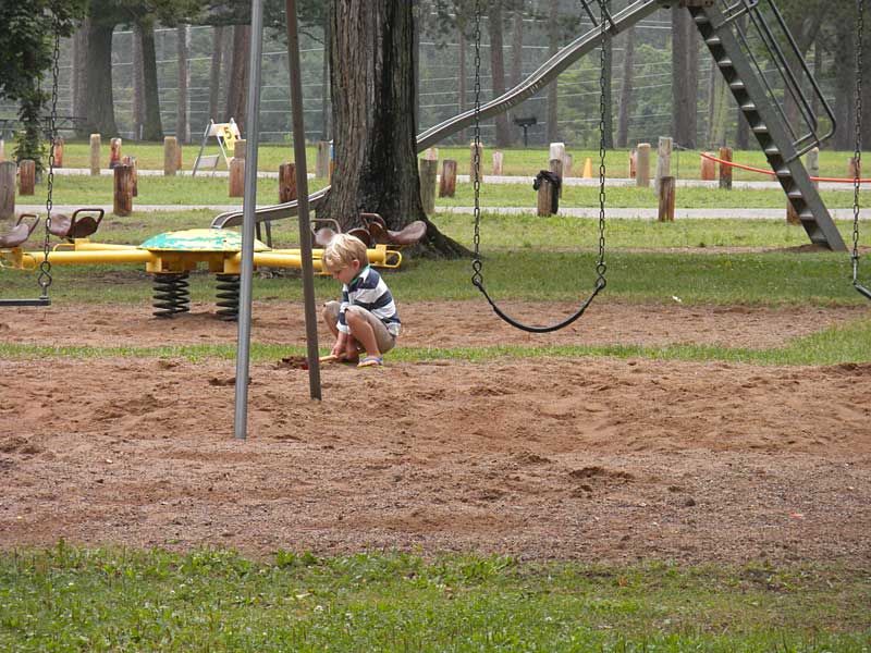
Reid spent a lot of the time using his beach shovel to dig up the sand in the playground. People are probably still tripping in all the holes he left behind.
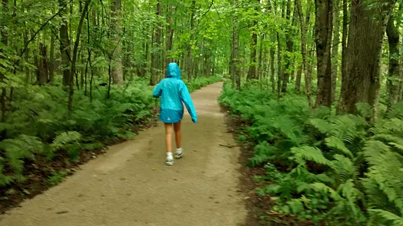
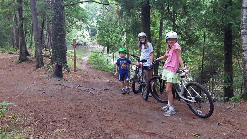
Marquette Mountain Biking – Gorge-ous Trail and Grom Loop
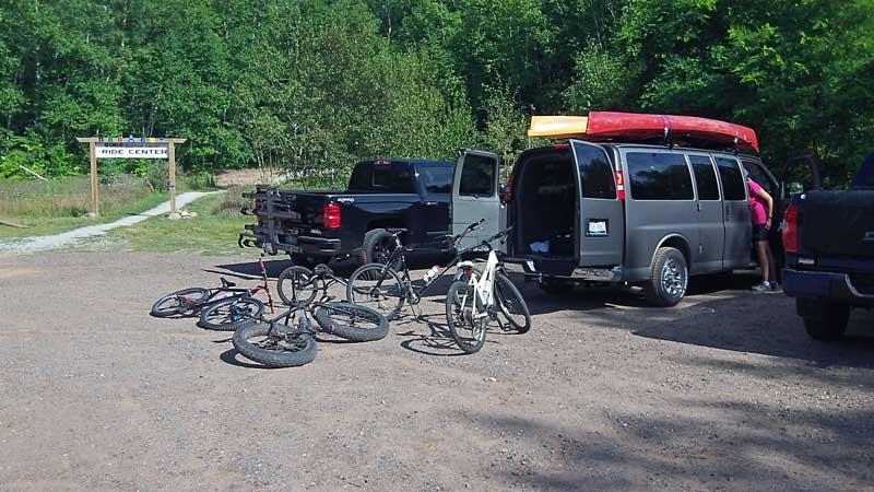
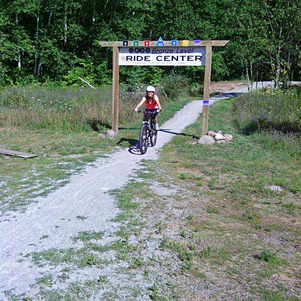
The main attraction in Marquette, at least for me, are the mountain biking trails. The trails here were designated by IMBA as a Bronze Level Ride Center in 2014. After setting up camp and eating lunch the family dropped me off at the South Trailhead so I could get in a quick ride while they went out to pickup a few supplies.
I first rode the Gorge-ous Trail (shown in the video above) and then looped back to the parking area on second half of the blue for about a 4.5 miles loop. The kids were not back yet so next I decided to climb up the Benson Grade and ride back down the Flow Trail. I must say after riding the Flow Trail up in Copper Harbor this trail with the same name was a little disappointing. It is fairly tight and technical and didn’t really “flow” that well.
After this everyone was back and it was time for a family ride on the Grom Trail.
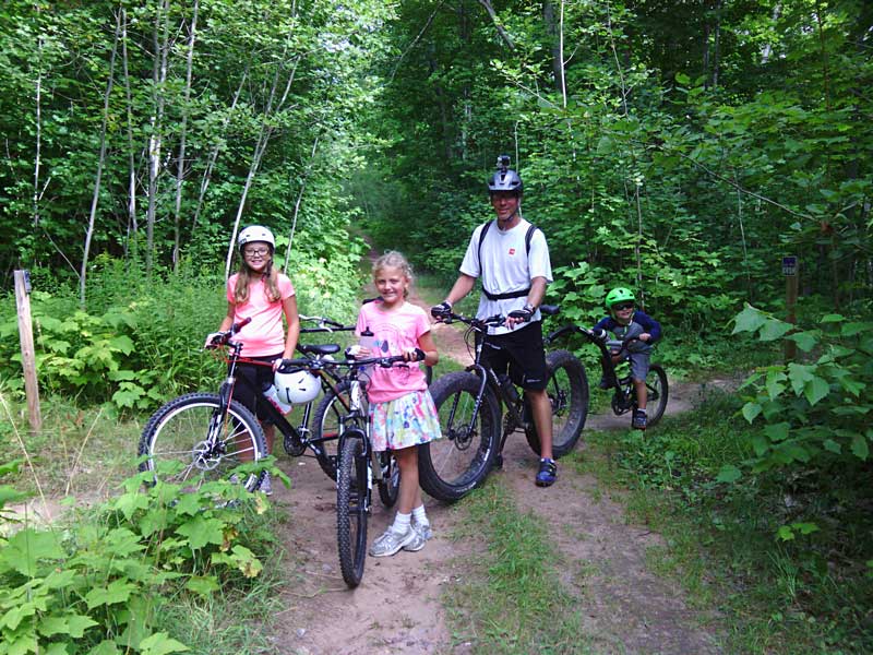
The Grom Loop also starts from the South Trailhead. This kids loop is about 1.25 miles long and is designated with purple markers. The trail has been cleared of most of the rocks and roots and is a relatively smooth ride. This was a highlight for our kids on our last visit and they were excited to try it again.
In case you were wondering what a Grom is, this is the definition from Wikipedia: “A grommet(grom) is a young participant in extreme sports. Originally, a grommet was a surfer under the age of 16. In recent years, this has expanded to include other extreme sports, most notably skateboarding and snowboarding.”
Regan finishing the ride.
Reesey riding the obstacles at the trailhead.
**To see a video of the Grom Trail visit our Marquette Mountain Biking Page >>
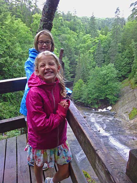
Climbing Sugarloaf Mountain

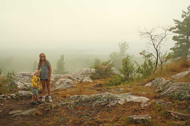
After biking we went back to the campsite for dinner. While eating we checked the weather and it was not looking good for the next few days. We decided we better take advantage of the sunshine and clear skies while we had it, so we drove out a couple miles north of town to climb Sugarloaf Mountain.
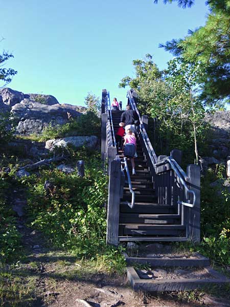
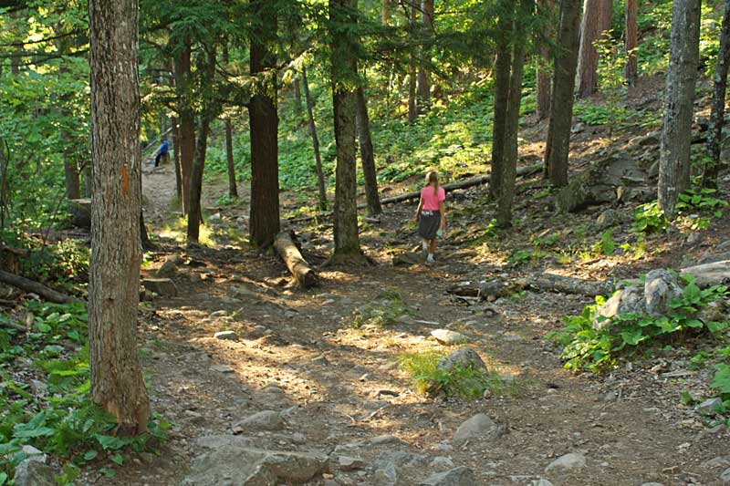
The “easy route” to the top is about a 1/2 mile long and is a mix of rocky trail and wooden stairways. The kids counted just over 300 steps on the way to the top.
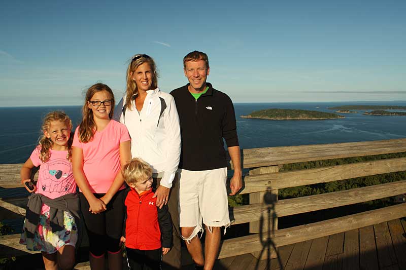
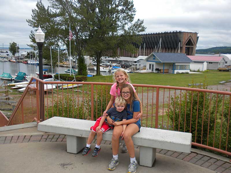
A family pic at the Sugarloaf Mountain overlook.
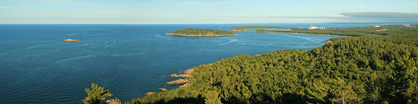
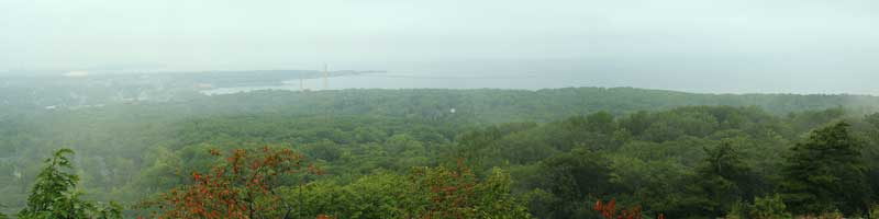
The view looking south toward Marquette.
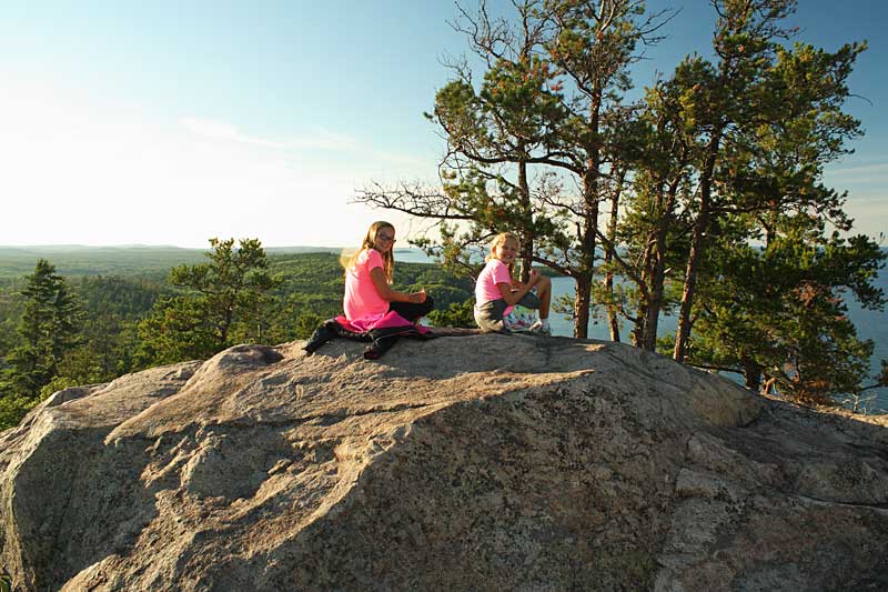
Resting and taking in the view from the rocky summit.
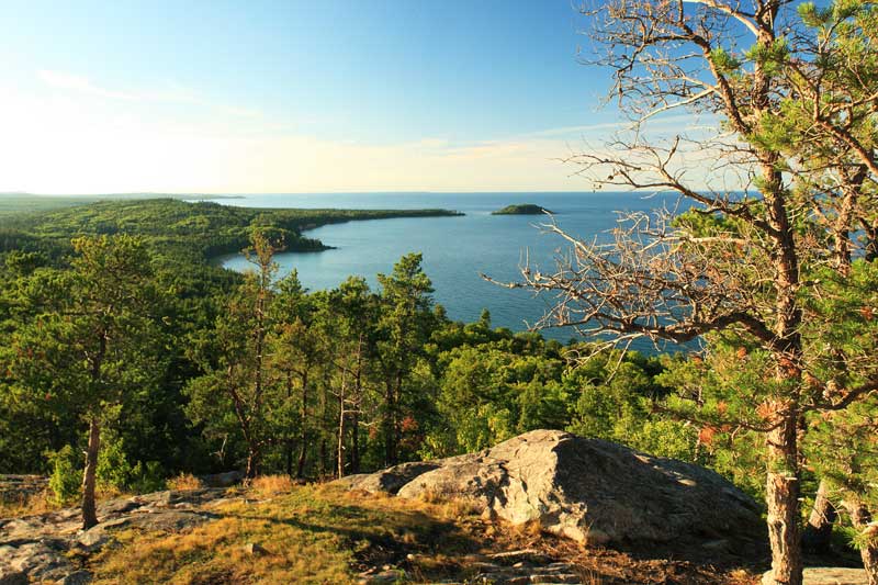
Little Presque Isle to the north.

For more info on this hike see: Best Hikes with Children in Michigan
Directions to the Sugarloaf Mountain trailhead >>
Marquette Rainy Day – Iron Industry Museum, Jean Kay’s Pasties and Downtown
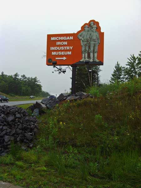
Unfortunately the weather forecast was right and we woke up to rain the next morning. The first rainy day activity on our list while in Marquette was visiting the Michigan Iron Industry Museum.
When using the address given on their website in our GPS it had us turning off into a neighborhood well before the actual entrance. I think the entrance coming in off from US41 is new and has not been updated yet in mapping applications. It is best to watch for the big sign above on south side of US41 about 10.5 miles west of the roundabout in Marquette.
Click to see the entrance location on Google Maps >>
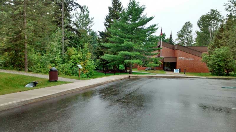
Admission to the museum is free. Donations are appreciated, but there was no pressure to make one.
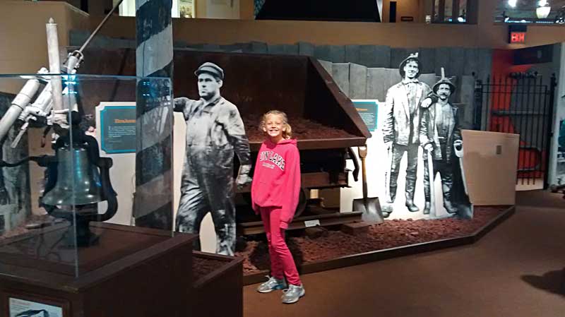
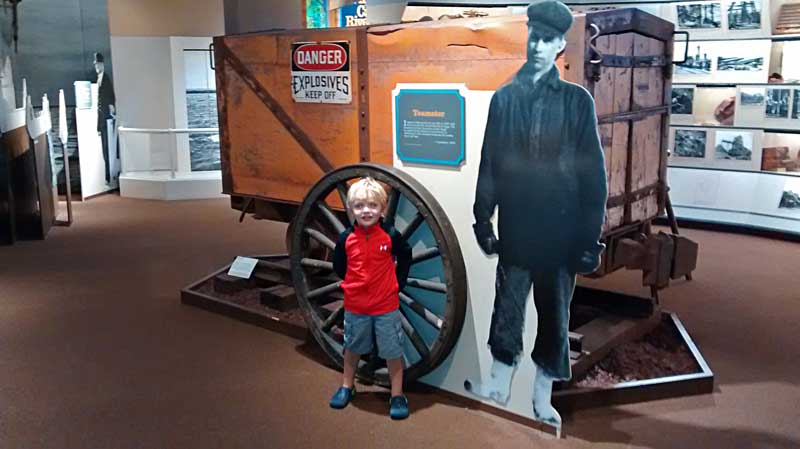
We spent about a half hour reading the exhibits and looking at all the artifacts. Soon it was time to go up and watch the movie in the auditorium. They show an interesting 20 minute video that really helped us get a feel for what life was like back at this time in Michigan history. After just being at Fayette State Park and seeing the iron smelting operation it was nice to come here and learn about where all the iron ore came from. It really helped tie everything together for us.
The movie shows every hour and they ask for a $1 donation per person to see it.
After the movie we went back down to see the last few exhibits that we missed. Then we almost had to drag the kids out of the big gift shop on the way out. I must say that we didn’t expect very much from a free museum, but it ended up being a great way to spend rainy morning and we would recommend planning an hour or two to stop here if your are in the area. If it is nice out, there are also outdoor walking paths around the museum to explore.
Michigan Iron Industry Museum website >>
More reviews of this attraction on Trip Advisor >>
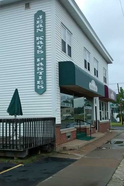
For lunch we continued with the mining theme by visiting Jean Kay’s Pasties. Pasties are a pie crust pocket filled with potatoes, onion, rutabagas, and seasoned beef. They say that the pasty was originally brought to the Upper Peninsula by Cornish immigrant miners. The portable pasty was the preferred lunch to bring down into the mines.
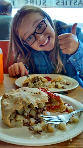
Jean Kay’s is consistently ranked as one of the top places to eat in Marquette. It is a small mainly takeout restaurant with just a few tables inside. We were lucky that one of the 2 booths opened up just as we were placing our order. The group behind us had to stand and eat around one of the high top tables in the window. This was the first pasty for the kids and it was thumbs up all around the table. Jean Kay’s also serves warm subs, salads and wraps that looked good too.
Jean Kay’s website and menu >>
More reviews for Jean Kay’s Pasties on Trip Advisor >>
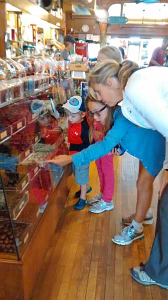
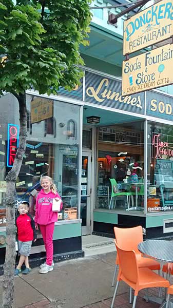
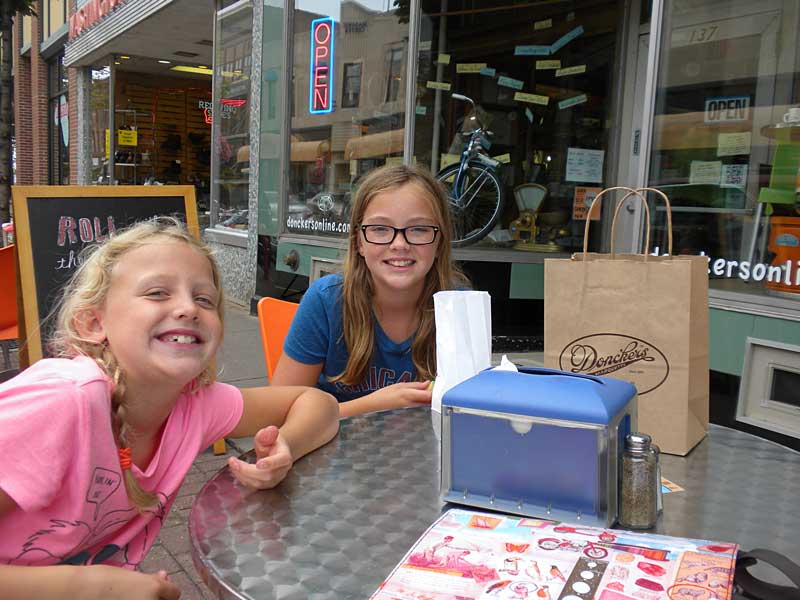
After lunch the rain was starting to let up so we went downtown to visit Doncker’s Candy Store which is also a top ranked restaurant and soda fountain. Everyone picked a small bag of their favorite candy from the old fashion candy counter.
After Doncker’s we walked around and checked out the rest of downtown. We visited a couple stores with toys and souvenirs, but the only thing that really stands out is Book World. This large store has a unique combination of books, magazines, gifts and a smoke shop. We all kept busy for a while browsing books and magazines. The kids each found a new book which was good to have for some rainy day reading.

Regan found this sticker for the wall above her bed…. I can’t argue with this.
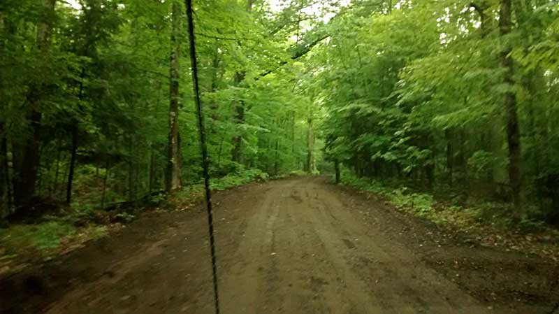
Before heading back to the campsite we went to try and find the road to the top of Mount Marquette.
The directions from the Travel Marquette website were pretty good: From South Marquette, travel on US-41 about 1.5 miles south, up the big hill and partly down the other side to Cliff’s Power Road on the right. Go right,then down the hill and along the river for about a mile until you see a sign one the right indicating Mount Marquette. Take this dirt road and proceed on way up the winding hill to the summit.
The road to the top was a little steep at times, but it was smooth enough that I think you could make it in almost any car.
We stopped at the first pullout on the right thinking we were at the top. After getting out and seeing the foggy view we realized that we were not quite there.
A little further up the road there is a bigger pull off area and a short rocky trail leads up to the main Mount Marquette overlook. The fog was getting a little lighter and we could at least see the city better than on our first stop. From here we contiued back down the other side and back to the Tourist Park.
After eating dinner at the campsite the rain moved back in and we had to spend the rest of the night inside the camper reading and watching movies.
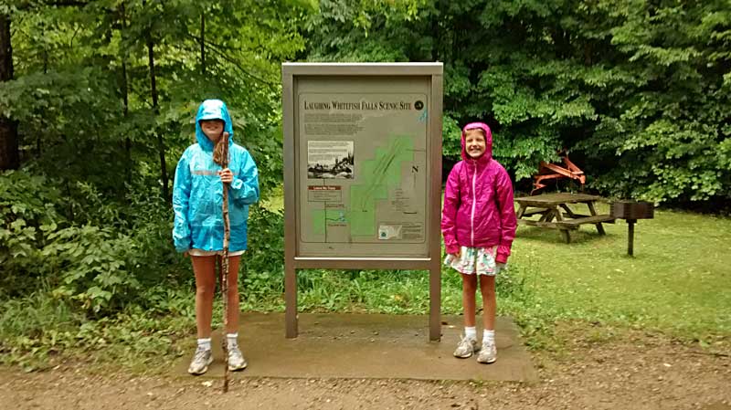
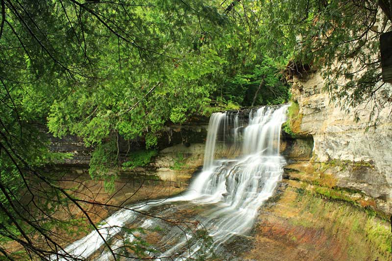
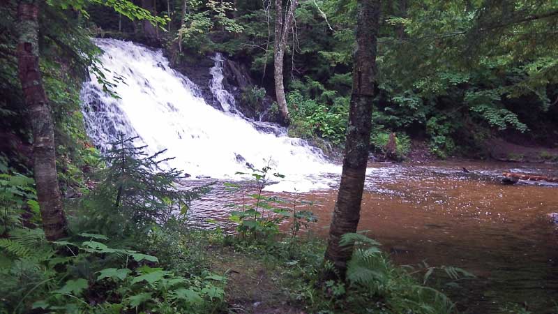
Laughing Whitefish Falls Scenic Site
The next morning it was still raining and we had already used up our rainy day activity list the day before. So I got out the guide books and smart phone and had to come up with another rain day plan.
The first thing on the agenda was Laughing Whitefish Scenic Site. Visiting the falls here has been on our to do list for a while, but the location is kind of in the middle of no where between Marquette and Munising. It is about a 50 minute drive from either city and it just has not worked into our plans the other times we have been in the area. However, since it was raining and we did not have much else to do a 50 minute drive didn’t sound too bad on this day.
To reach Laughing Whitefish Falls it is about a 0.6 mile hike down a wide gravel path that looked like it was recently improved.
If you have an umbrella or rain coat hiking to a waterfall in the rain is not a bad option. Unless it is coming down really hard, the rain doesn’t really obstruct the view of the falls and it can even help bring out the color of the surrounding rocks.
The trail ends at a deck overlooking the top of the falls.
From the top viewing deck there are stairs that take you down along the left side of the falls to the bottom of the gorge.
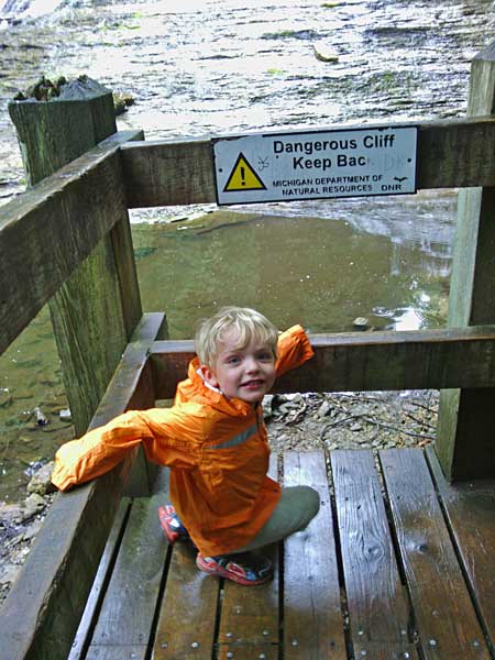
Reid at the bottom of the falls. The wet steps were pretty slippery so we had to take our time on the way down.
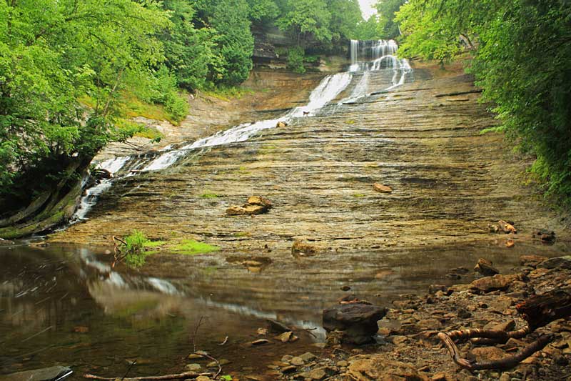
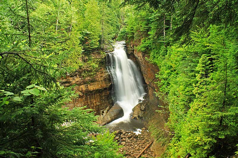
I have read that when the water is high, Laughing Whitefish Falls is considered one of the most spectacular cascades in Michigan. Dropping 100 feet it is the 4th highest waterfall in the state. According to Gowaterfalling.com it is the tallest waterfall that can be easily visited. For a listing of all the waterfall heights in Michigan see the World Waterfall Database website.
As we were climbing back up to the top of the falls the rain started to let up and we could even take off our rain jackets for the hike back to the car. The next thing on the agenda was lunch so we drove to Munising and back into some more rain.
While I was researching our plan for the day I came across High Fives which is a combination restaurant and bowling lanes. We thought we had the perfect plan for a rainy afternoon with food and a round of bowling all at the same place. However, when we walked into High Fives just after noon they informed us that the kitchen would not open for another couple hours. Our backup plan was Johnny Dogs which is a small hotdog stand that seems to be a local favorite. Although, when we found them we saw that they only have outdoor seating. It was covered, but everyone looked pretty damp and cold sitting out there eating in the rain.
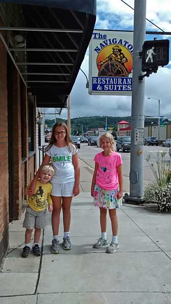
We finally ended up at the Navigator Restaurant which is located right near the tour boat docks. The Navigator has mixed reviews, but we thought the food and service were both pretty good. The menu is typical bar and grill food. However, they did have pasties so Regan went for her second one is as many days. If you are paying close attention you will notice that the photo above was taken later in the day after the weather cleared.

After lunch we walked across the street and back to High Fives for a round of bowling. This was Reid’s first time and it took a while for the ball to get to the pins, but he was having a great time. The best part was about half way through our game we looked back out the windows and the sun was coming out.
Walking back to the car after bowling we found that the weather had gone from cool and wet to hot and steamy.
Miners Falls and Miners Castle Pictured Rocks
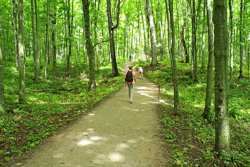
Next we drove to Pictured Rocks National Lakeshore to see Miners Falls. The trail to the falls here is very similar to the walk to Laughing Whitefish Falls. It is also a wide gravel path that is 0.6 miles long. Everyone must have been excited to see the weather finally break after a couple days of rain because the parking area was packed and the trail was the busiest we had ever seen it.

Reid’s favorite trails are interpretive with numbered posts to find along the way.
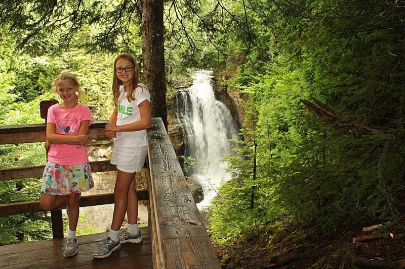
We had to wait in a line on the steps for our turn at a picture on the small overlook deck.
Miners Falls is about 40 feet tall and it has always had pretty good flow every time we have visited it.
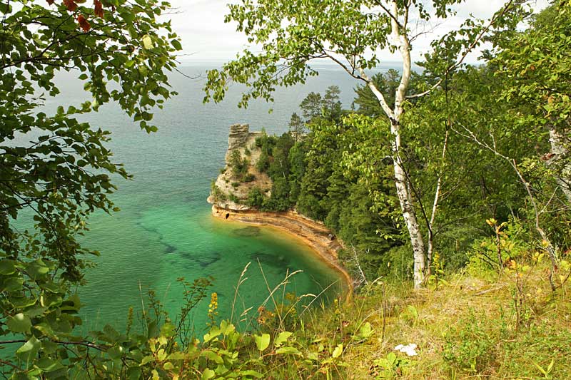
After hiking back from the falls we figured that since we were already in the area we should make a stop at the Miners Castle before heading back to Marquette.
Everyone one else was getting tired so just Regan and I walked down the short trail to the viewing deck on top of Miners Castle. It is hard to see in the photo, but there was a bald eagle roosting in a tree along the path.
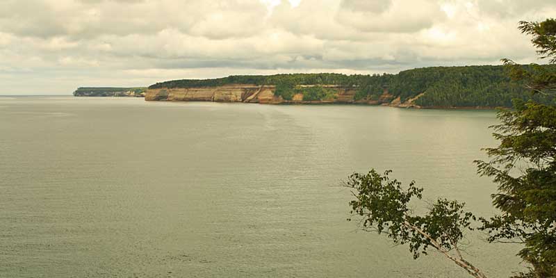
Looking out towards the Pictured Rocks cliffs from Miners Castle.
Regan trying to recreate the photo memories from 5 years prior.
On the drive back to Marquette we encountered another storm moving in from the west.
We didn’t really want to spend the whole night in the camper again so we detoured to Buffalo Wild Wings on our way back to the campground. We usually try to avoid chain restaurants when traveling, but in this case we decided eating wings and watching the Tigers game would be a good way to kill part of the evening.
Mountain Biking the Marquette South Trails
Things finally dried out by the next afternoon. Mom and the kids went for a bike ride on the City Multi Use Path from the Tourist Park to downtown and I went back to ride more of the South Mountain Bike Trails.
I again rode down the Gorge-ous Trail, but this time I toke the bridge over the Carp River and continued on the yellow trail to the top of Marquette Mountain Ski Area. After riding down the ski hill I crossed the road and took the new Carp Eh Diem or green trail to Morgan Creek Falls. (This is the section shown in the video above) From here I looped back to the trailhead on the yellow trails named Pipe Dreams and Off Grade. This made for a fun and challenging ride of about 9.5 miles. The trails up here are mostly rock and sand so even after a couple days of rain they were in really good shape.
Stopping to see Morgan Creek Falls on the Carp Eh Diem Trail.
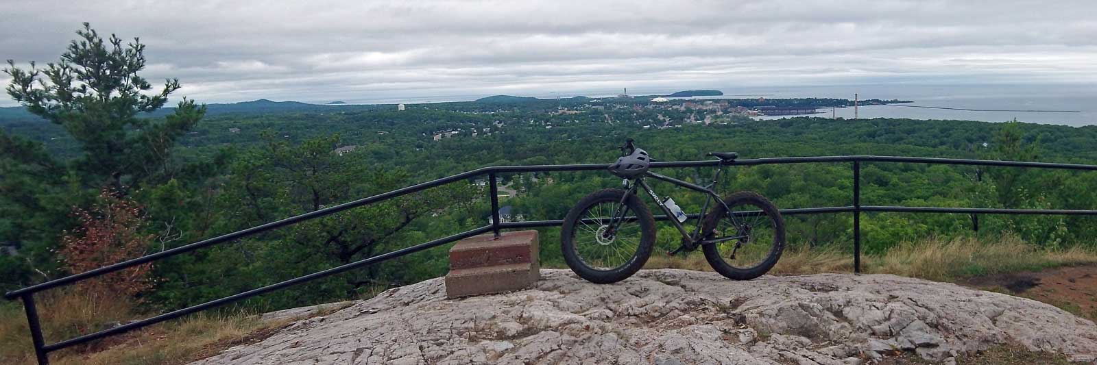
I took a short rest at the trailhead and then decided to do a lap on the 3.8 mile Mount Marquette or Blue Loop. I have done this ride a few times before and it never disappoints. It is called “one of the signature trails in the Marquette single track system.” At the top of the main climb there is a spur trail that leads to the Mount Marquette overlook. This time you could see a little better, but it was still pretty overcast.
Click here to see the larger version of this photo >>
To see the helmet cam video from the Mount Marquette Blue Loop click here >>
Biking from the Tourist Park to Downtown Marquette
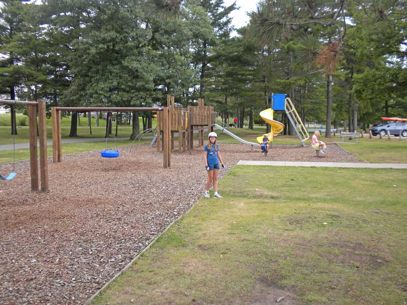
It is about a 3.5 mile ride on the Marquette City Multi Use Path to get to downtown from the Tourist Park. With most of the path running right along the lakeshore it is a nice and scenic ride. There are 2 different parks with playgrounds along the route. The kids were excited that mom let them play at them both. Their first stop was at Shiras Park. It is right on the water with a nice sandy beach and a view of the Picnic Rocks off shore.
It is always a good idea to keep your helmet on for safety at the park.
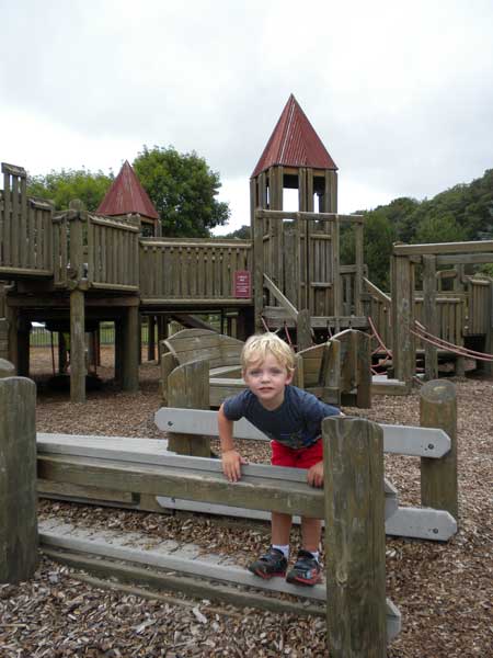
The next stop on the route was Lower Harbor Park. This nice waterfront park has a big wooden play structure and a concession with ice cream and restrooms.
Resting along the path that connects Lower Harbor Park to downtown.
Their last stop on the bike trip was another visit to Doncker’s for more candy.
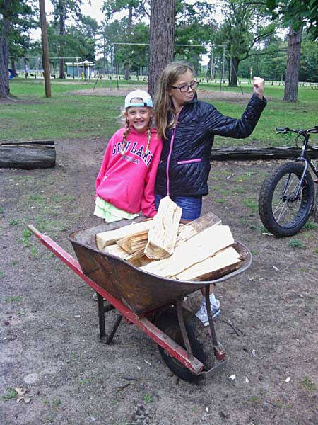
The girls bringing back a load of wood from the campground office. We spent the rest of the evening grilling and relaxing by a nice big fire. It felt really good to be back outside for the night.
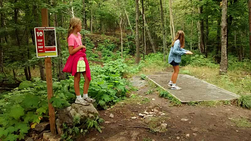
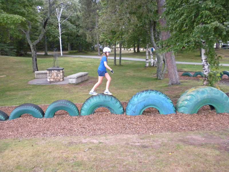
The next morning we walked across Big Bay Road to the disc golf course at River Park. It was a fun course that is well marked with more elevation change than we are used to playing back home. It was also nice that they had shorter tees for the girls. Another bonus were the Thimbleberries we found to snack on along a few of the holes.
In the afternoon we decided to drop our van off at to shop right near the Tourist Park because the AC went out on the way up. We were leaving and heading back south the next morning and the forecast was for hot and humid weather for the weekend. With only a few windows that can open in the back of the van it gets warm in a hurry without the air working. This meant that the rest of the afternoon our main mode of transportation would be our bikes. The kids and I went to check out some of the trails along the Dead River to the north of the campground while Mom got to go out on her road bike.
The North Trails are less technical with nice views of the river and some interesting rocky cliffs that I did not expect to find over here. For the most part they were good for the kids with just a few places that they had to get off and walk.
Kim went back to the City Multi Use Path and continued south out of town for a nice ride along the water.
Click here to see a Trail Genius map and video of this ride >>
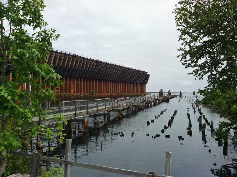
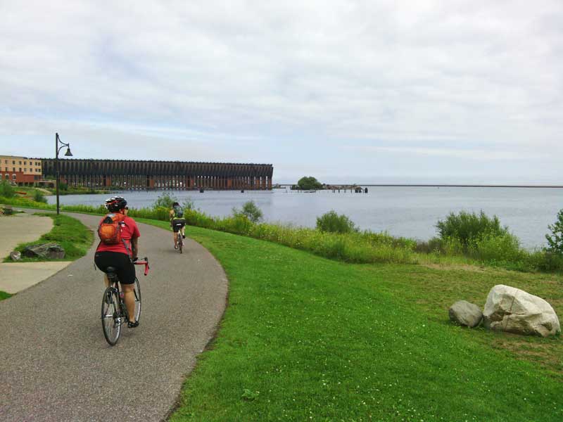
The view of the old ore dock and pilings from the bike path.
They did not have our van fixed by closing time so we were stuck at the campground for the evening. It was another night of relaxing and quality family time around the fire. Our departure the next morning was delayed by a few hours while we waited for our vehicle to be done. Around 11 am we got the call that it was ready so Regan on biked over to pick it up. We had to run into town to fill up on gas and since Jean Kay’s is right there, we grabbed a bag of pasties for lunch. I figured everyone would already be getting hungry and I didn’t want to have to stop as soon as we started driving. Finally, just after noon we had the camper hooked up and were headed down the road toward Petoskey State Park.
Unfortunately the weather and getting our vehicle repaired kept us from doing everything we had planned to do in Marquette. Someday I would still like to paddle around Presque Isle Park and jump in from the Black Rocks Cliffs. There are also several bike and hiking trails north of town that are still on the list including the climb to the top of Hogback Mountain. Then there is the beach at Little Presque Isle and….I guess we need to plan another visit. If you like being outside you will find plenty to do in Marquette.
Continue along with us to our next stop at Petoskey State Park >>
![]()
![]()
![]()
![]()
![]()
Our Favorites

I have had my GoPro camera for a couple years now and we are still finding new ways to use it to document and share our adventures. It is easy to use and the photo and video quality has been surprisingly good.
Connecting to the GoPro using the smart phone app and the camera’s built in Wi-Fi is a really nice feature that allows you to control the camera, change settings and view your videos. The app also has a live view feature that lets you view what the camera sees on the screen of your smart phone. I have found this very useful for framing shots because there is not a screen or view finder on the camera.
Click here to find GoPro cameras on Amazon >>
Advertising Disclosure: We may receive a commission if you click a link on our site and purchase one of the products or services that we recommend.
Leave a Reply