Copper Harbor – August 16 to 22, 2013
For our August camping trip we decided to head back up over the bridge for the second time of the summer. Most of the week was spent up at the tip of the Keweenaw Peninsula in Copper Harbor. We we spent a few days here back in 2008 and we were ready to make the long drive again to see more. On the way home from Copper Harbor we also stopped at Pete’s Lake Campground just south of Munising and Cheboygan State Park.
After having a fair amount of rain when we camped in the Eastern Upper Peninsula in July, this time we were blessed with plenty of sunshine and not a single drop of rain for the entire 10 days.
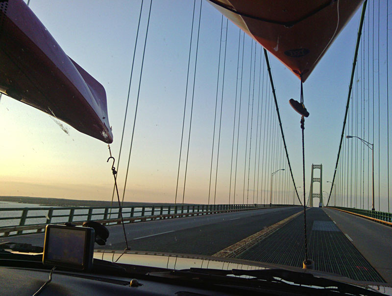
We left again on Thursday night after work and made it over the bridge just as the sun was setting. We made our usual stop at the Straits State Park in St Ignace for the night.
Camping at Fort Wilkins Historic State Park:
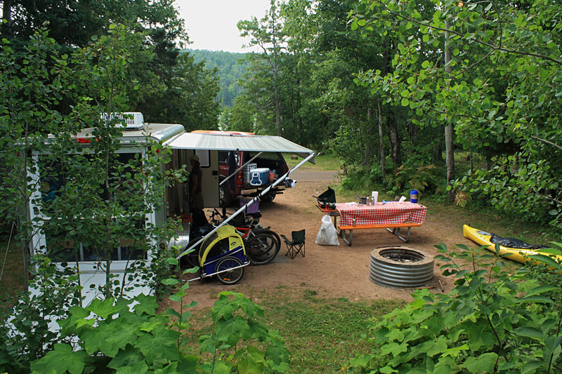
In the morning we still had about another 6 hours of driving to make it up to Copper Harbor. We finally pulled into campsite 172 at Fort Wilkins State Park by late afternoon. We chose to make our reservation in the West Campground. Most of the sites in both the East and West Campground loops are close together. There are a few more trees in the West Campground that give you just a little more privacy.
Each Campground loop has a single bathhouse. The West bathhouse by us was older and only had 2 showers for the entire loop which meant that there was occasionally a line. One afternoon while our bathhouse was being cleaned I biked over to use the East bathhouse and found that the shower building here was remodeled on the inside and had more showers that were really nice. If the bathhouse facilities are important to you I would staying in this loop. There is also free WiFi internet at each bathhouse building. We could sometimes get the signal at our campsite depending on the number and size of the campers in between us and the transmitter.
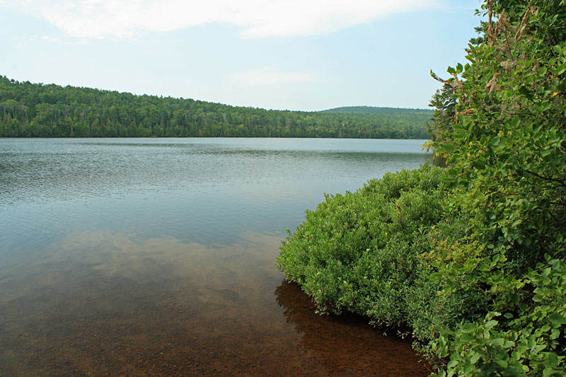
The view of Lake Fanny Hooe right across the road from our campsite. Both Campgrounds are on the lake, but the sites are all on the oposite side of the road as the water.
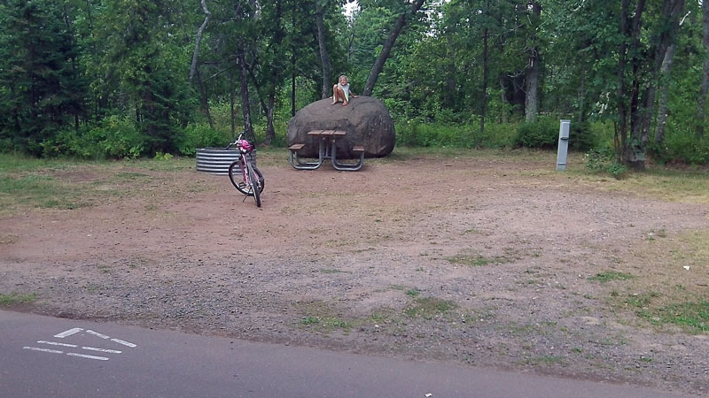
The girls were disappointed that we did not stay at the site with the big rock. They were at least able to visit and play on the rock on a few different times when the site was open.
The campground was almost full on the weekend, but only at about 50% capacity during the rest of the week.
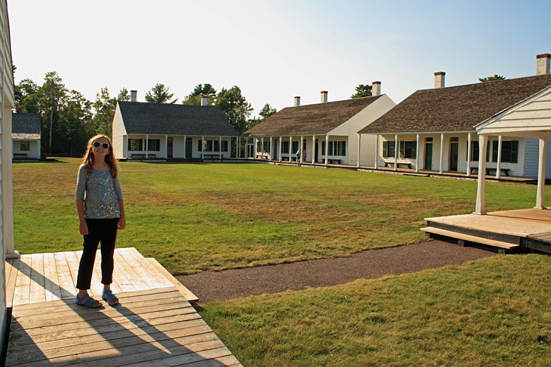
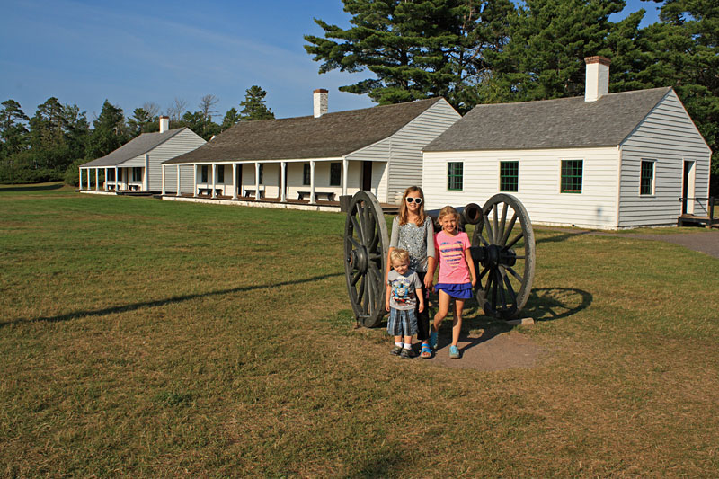
Historic Fort Wilkins:
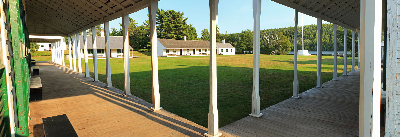
After getting settled into our campsite and eating dinner we rode our bikes over to see the Historic Fort. The Fort restoration is really well done and it is worth planning to spend at least an hour going through it if you are up here. We had to take turns chasing our 2 year old around so we each only got to read about half of the displays.
Click here to see the larger version of this photo >>
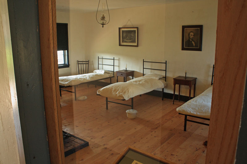
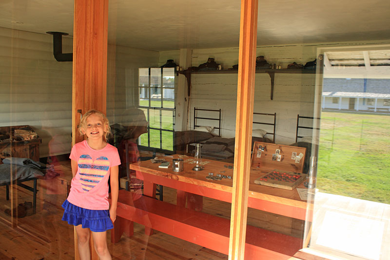
The inside of the post hospital building.
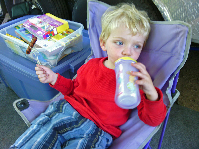
Regan happy to be out of the truck.
The barracks.
Someone will not look at the camera.
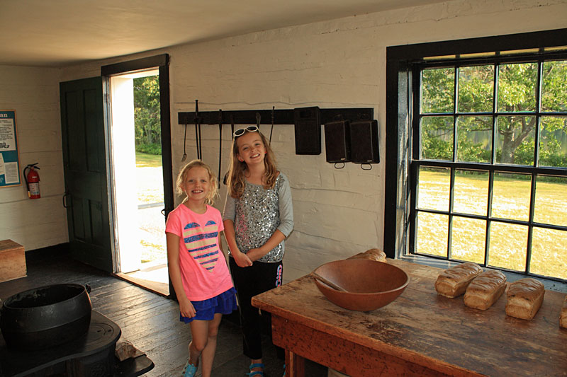
The bakery was a favorite.
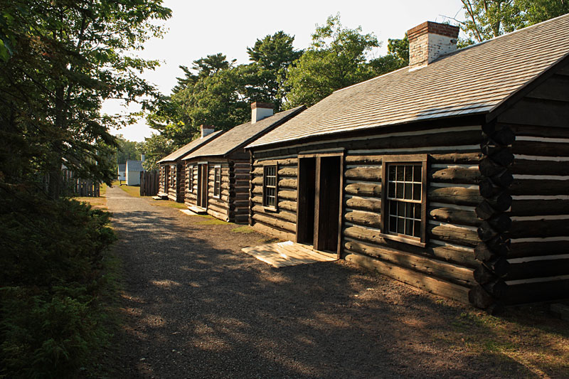
Just outside of the wall is a row of cabins that housed married enlisted men.
Just up the walk from here there is a park store that has souvenirs, packaged ice cream, camping supplies and ice.
This is the Fort Wilkins informational video that was playing inside one of the cabins.
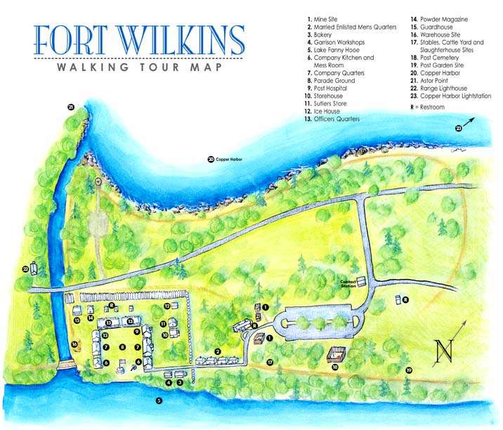
The map of the Fort Wilkins area.
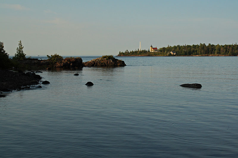
After visiting the Fort we walked across the road to the viewing area for the Copper Harbor Lighthouse. The only way to reach this lighthouse is by boat. We paddled our kayaks out to it on our last visit, but did not make it this time. There is also a tour boat that leaves from the Copper Harbor marina. For more information on this visit: copperharbor.org/recreat/tour-char.html
One of the many treats that we have when we are camping are breakfast sausages or as the kids call them “breakfast hotdogs.”
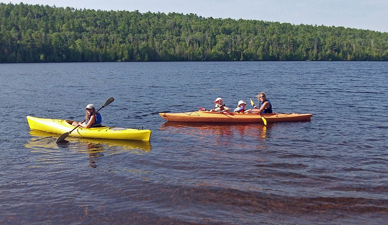
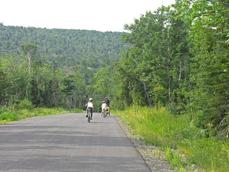
In the morning I was ready to ride the mountain bike trails. Before heading off on the bike I helped mom and the kids launch the kayaks in Lake Fanny Hooe right across from our campsite.
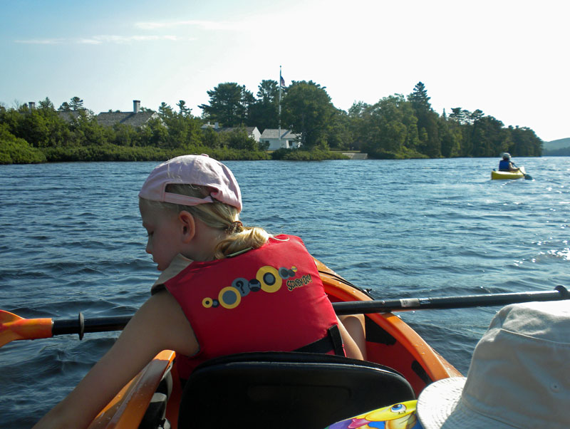
Paddling past the Fort.
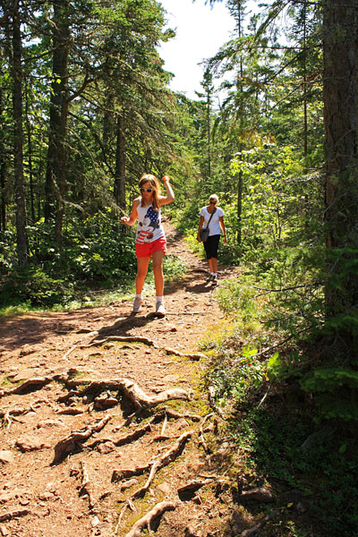
Copper Harbor Mountain Biking – Epic Ride:
In October 2009 the trails in Copper Harbor were recognized as an Epic Ride by the International Mountain Biking Association. There are several other really good trails that have been added since this time and the Epic Ride loop is not as popular as it ounce was. Some of the trails have also been renamed. However, this ride has been on my to do list for a long time so it naturally it was the first thing I chose to ride. The video above is of me dropping back down into town on the Stairway to Heaven trail at the end of the ride.
To complete this ride you link several different trails together on both sides of US 41. Trail maps can be purchased for $5 at many of the retailers in town and at the Fort Wilkins Store. $5 may seem like a lot, but there is no fee to ride the trails and all of the money collected goes right to the Copper Harbor Trails Club to help them maintain and develop this awesome trail system.
From what I could figure out from the maps the Epic Ride now consists of the following trails in order: Copper Harbor Loop, Garden Brook – Sec 1, Garden Brook, Woopidy Woo – East, Woopidy Woo – West, Garden Brook – Sec3, Blue Trail, Dza Beet – Sec 1, Here We Go – Sec 1, Ma Maki – Sec 1, Ma Maki – Sec 2, Say Hello, Dza Beet – Sec 3, Dza Beet – Sec 4, De Deet – Sec 2, Red Trail, Mango, Ma Maki – Sec 3, Ma Maki – Sec 2, Der We Went, Stairway To Heaven, Copper Harbor Loop.
This ride is still “epic” and I would recomend it as good introduction the the Copper Harbor Trail System.
I didn’t want to always stop and look at the map so I printed a trail list and rubber banded it to the top tube of my bike. If you would like to print a copy of the list click here >>
For more information visit the IMBA Epic Ride Page and the Copper Harbor Trails Club.
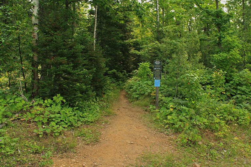
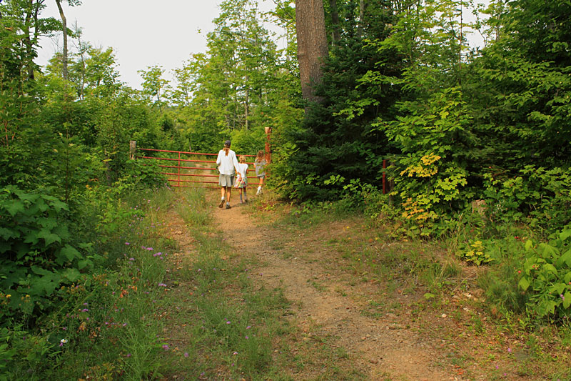
Mary Macdonald Preserve at Horseshoe Harbor:
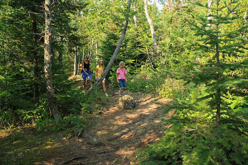
In the afternoon we drove out towards the end of the Keweenaw Peninsula and visited the Mary Mcdonald Preserve at Horseshoe Harbor. After turning off the main road it is just over a mile down the narrow dirt road to the trailhead. A few spots were at little rough but you should be able to make it even in a small car. Although, a couple groups parked their cars by the turnoff and walked down to the trailhead.
There are a few pull off parking spots on the right side of the road and the beginning of the trail to Horseshoe Harbor is marked with the post shown above.
A rough and rocky trail heads slightly down hill toward Lake Superior.
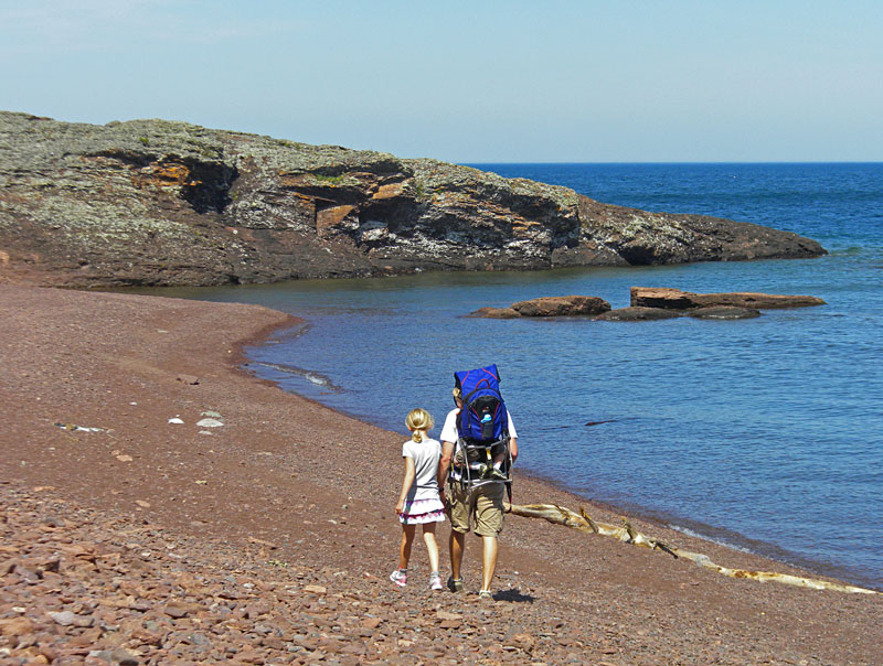
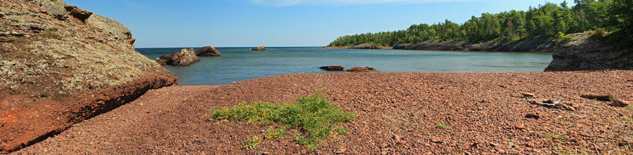
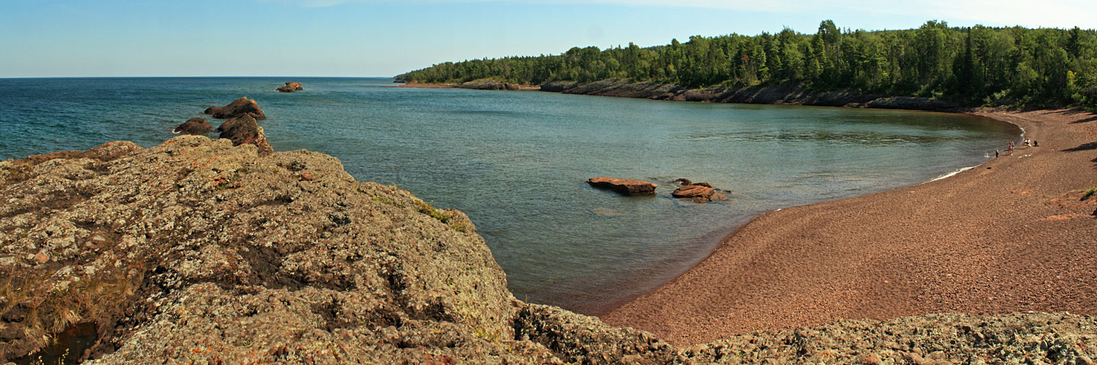
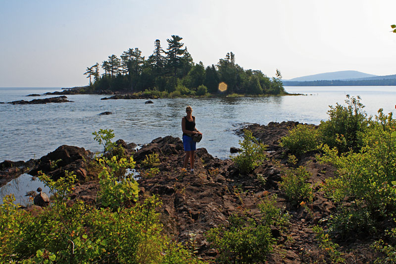
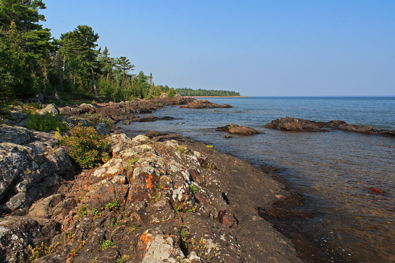
After about 0.35 miles you break out of the woods and on to the red rock shore of Horseshoe Harbor.
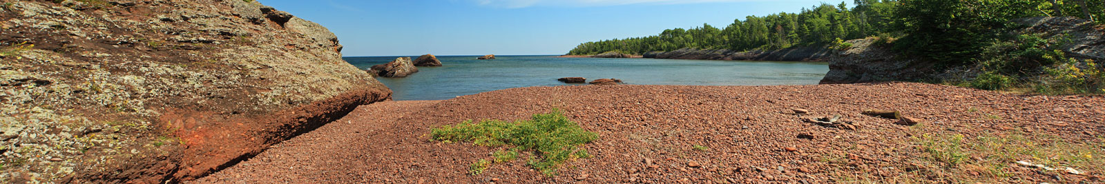
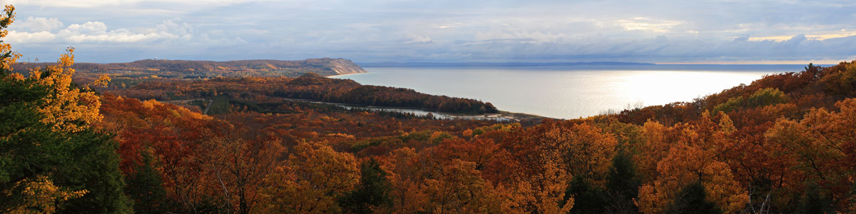
A panoramic of the harbor standing by the rock wall on the west end of the Harbor.
Click here to see the larger version of this photo >>
I
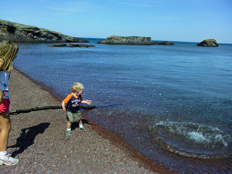
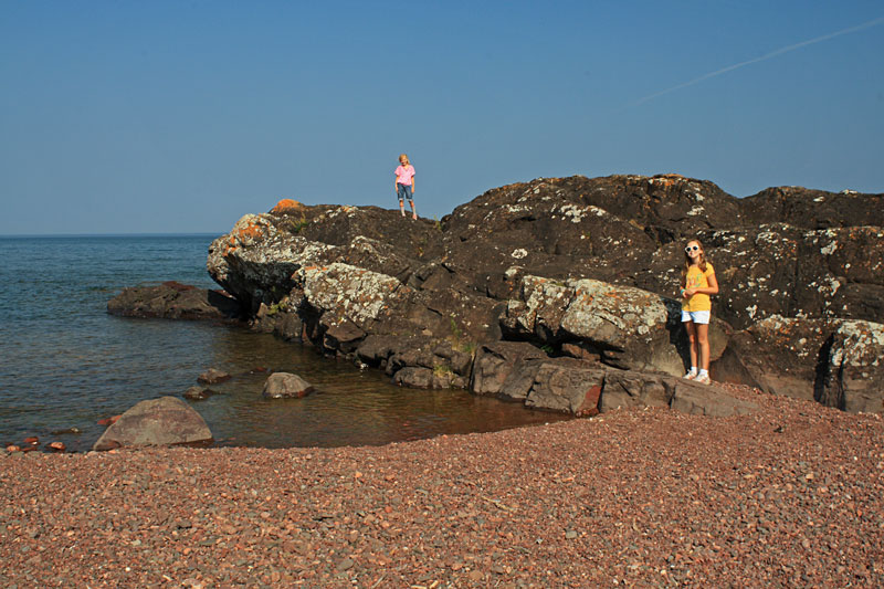
Reid learned that the bigger the rock…the bigger the splash.
While the kids were busy throwing rocks I climbed up to the top of the rock wall for a couple photos.
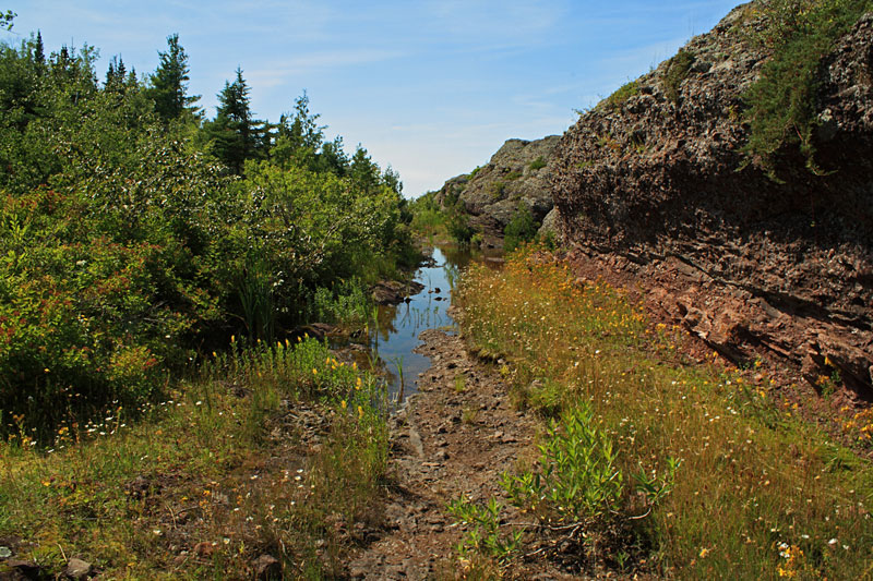
After throwing rocks into the lake for a while it was time to head back up the trail. Because of the flooded trail the hike was shorter than we planned, but it was still an interesting place to visit. We will have to bring sandals next time and try it again.
Directions to the trailhead >>
More info on the Mary Macdonald Preserve at Horseshoe Harbor >>
Brockway Mountain Drive:

We wanted Reid to get a little nap so before heading back to the campsite we drove to the top of Brockway Mountain.
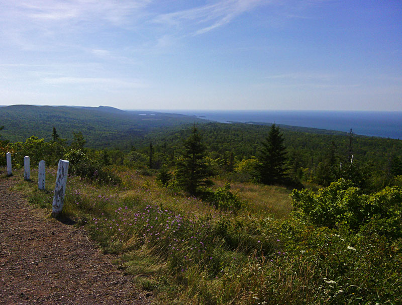
Looking west for the end of the Brockway Mountain Scenic Drive.
Looking back towards Copper Harbor. Somewhere under the trees is part of the trail that I rode in the morning.
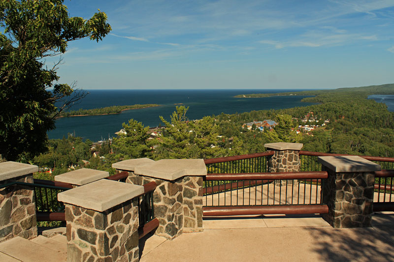
The Copper Harbor overlook from Brockway Mountain Drive.
After all of the day’s activities we were all pretty beat, so we spent the rest of the night relaxing by the campfire.
Bare Bluff Hike at Grinnell Memorial Nature Sanctuary:

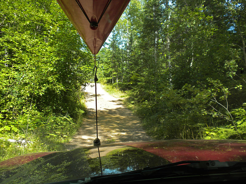
The next morning after breakfast we drove from Copper Harbor towards Lac La Belle to do the hike to the top of Bare Bluff. This is probably one of the more remote hikes we have been on as a family. From what I had read about this hike it sounded like just getting to the start of the trail was going to be half of the adventure. The trailhead is a 2.5 mile drive down a seasonal road that at times can be very rough and muddy. For us it was mostly dry with only a few rough spots. It think a car with decent clearance could have made it at this time of the year.
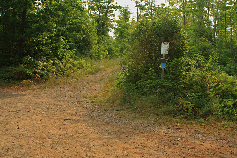
The parking area for the Bare Bluff Trail is marked with a small sign that says “Sanctuary Trail Head” and then “Stow all valuables out of site before locking vehicle.” I could tell that the combination of the seasonal road and the sign was making mom a little concerned about where I was taking them.
The first part of the hike is on the logging road that starts to the left of the sign.
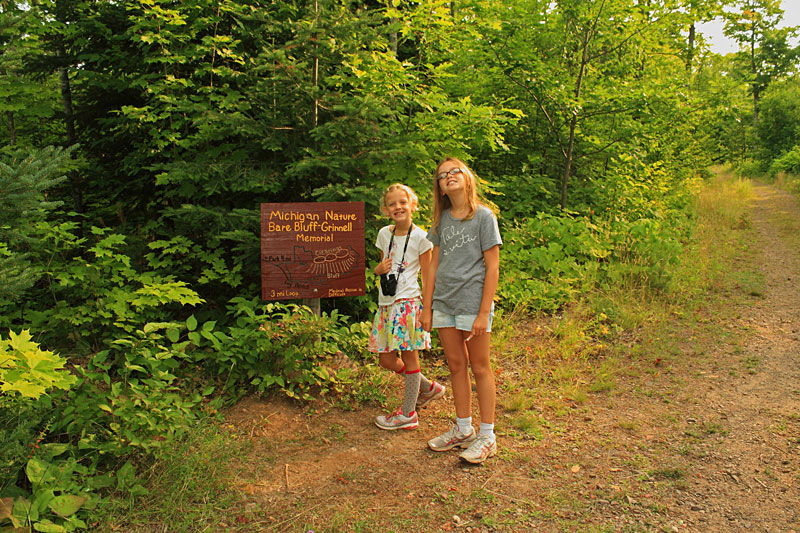
Just a little ways up the logging road there is a steel gate and then just past this was a wood trail map that let us know we were in the right place.
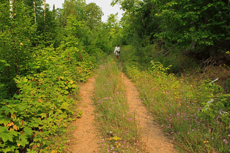
The route continues on the two track logging road for about 0.75 miles. The girls were not real happy about the weeds hitting there legs and all of the bees buzzing around. Although, it seemed to make for a faster pace than normal.
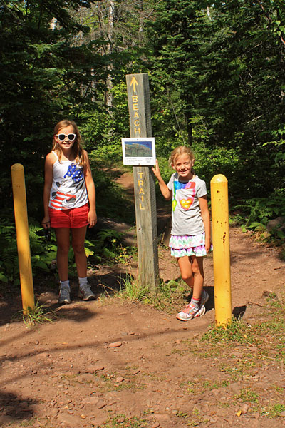
After about 0.75 miles you will see the sign above on the left side of the logging road marking the start of the Bare Bluff Trail. From here it is a steady climb on a single track trail to the top of Bare Bluff.
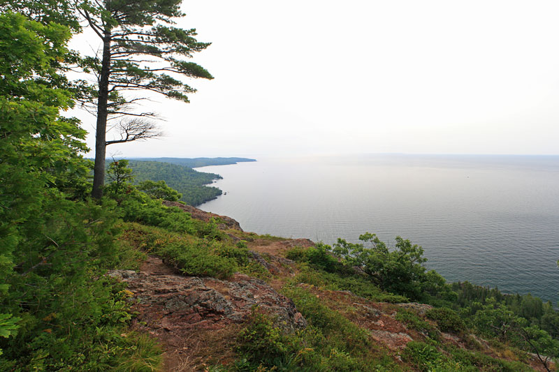
After about another 0.5 mile you break out of the trees right on the rocky edge of Bare Bluff about 500 feet above Lake Superior.
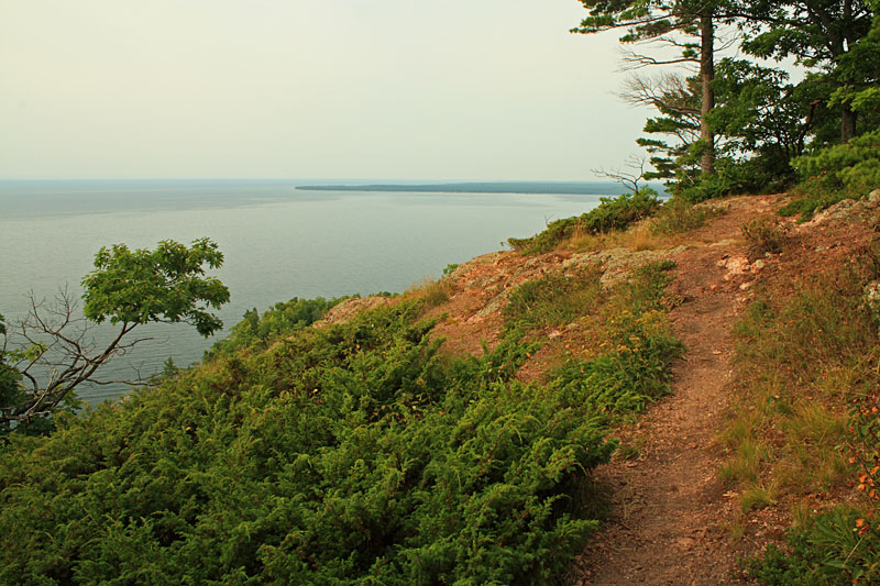
Looking east toward Bete Grise Bay.
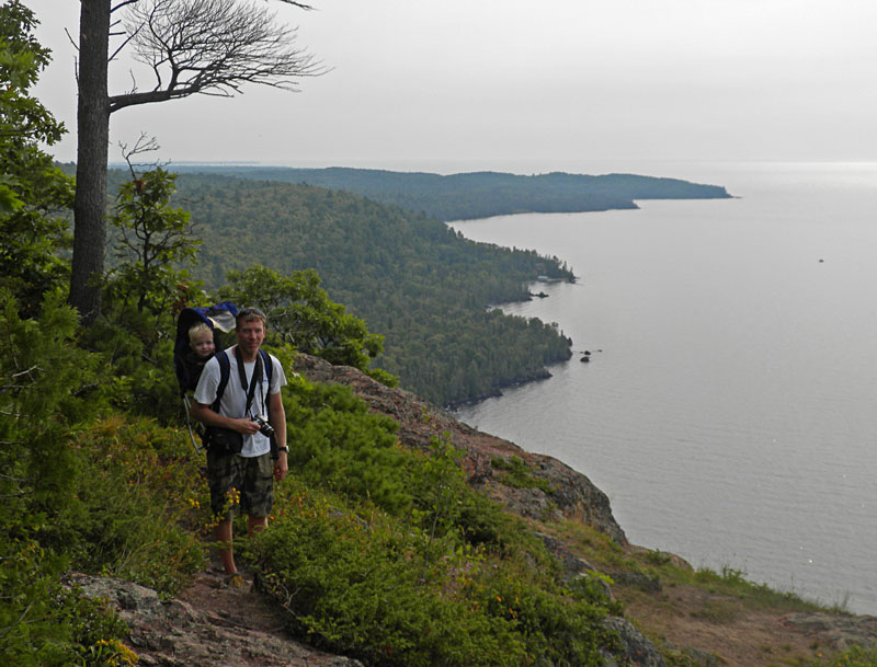
Reid and I with the Tip of the Keweenaw behind us. He really wanted to get out and walk, but that was not going to happen up here. We were not really comfortable letting the girls walk around either, so we found a nice rock for them to rest on.
After a short candy and water break we headed back down. We have learned that things always go better on the trail when there is the promise of a treat. The trail loops back down below the face of the cliffs, but it sounds like this part is pretty rough and not good for kids so we went back down the way we came.
Rounding the gate back near the parking area. The entire hike was 2.5 miles and took us about 1.5 hours to complete.
View Bare Bluff 8/18/2013 9:51am in a larger map
Our track in Google maps.
Directions to the Bare Bluff Trail Head: From Copper Harbor go west on US41 about 10 miles to Lac La Belle Road. Turn left and follow Lac La Belle Road for about 4 miles and then stay left as it becomes Bete Gris Road. In about 3 miles you will see Smith Fisheries Road on the left. Immediately after turning on Smith Fisheries Road there is an unmarked fork where you will need to stay to the right. There is also a “No Trespassing” sign that will make you wonder if your are in the wrong place, but from what I have read it is ok to pass through. From here it is about 2.5 miles down the narrow dirt road to the parking pull off for the trail. (47.397202,-87.911815)
This hike was also highlighted in: Hiking Michigan’s Upper Peninsula
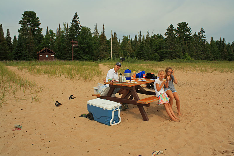
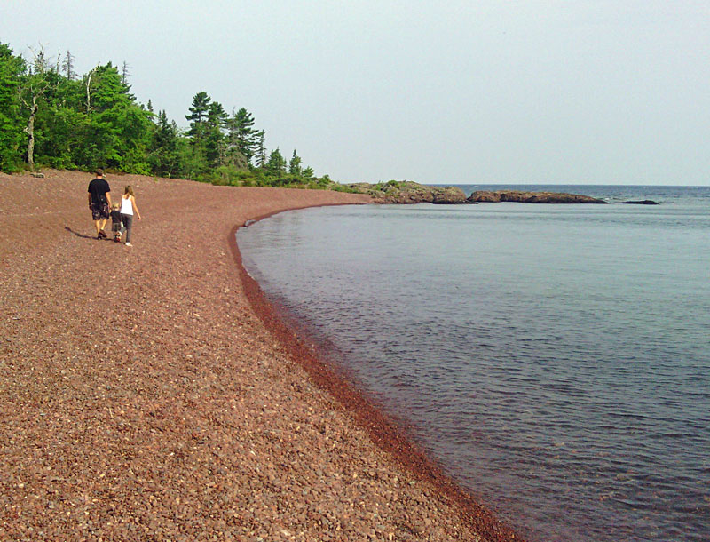
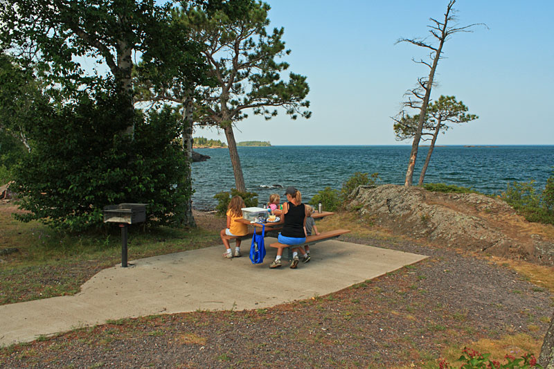
After our hike we drove down to the beach on Bete Gris Bay for lunch. The parking is along the road and there a few picnic tables down on the narrow strip of sand along the water. In the top left of the photo you can see the there are also pit toilets / changing rooms and the other side of the road.
From our picnic table you could see the bluff we just climbed.
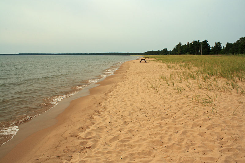
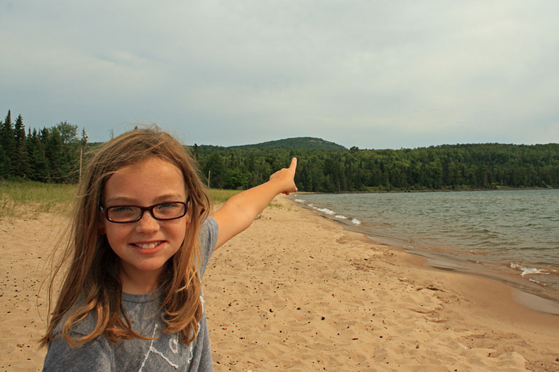
The beach continues for almost a mile up to the Lac La Belle channel. At first we had the whole place to ourselves, but by the time we finished eating a few more families were setting up for an afternoon at the beach.
After lunch we went in for a swim and found something interesting in the water. When we drove in it felt like there were small bubbles hitting us in the face. We also noticed the same thing when pushing our hands through the water. Upon further investigation we realized that the sand at the edge of the water was covered little clear fish eggs. Fish must have been spawning in the bay. We walked up and down the beach and the eggs continued as far as we went. No one was real excited about swimming in caviar soup, so after playing on the beach for awhile we decided to head back to Copper Harbor.
On the way back to our campsite we made a quick stop at Haven Falls Park on the west end of Lake Lac La Belle.
Copper Harbor Mountain Biking – The Flow
My legs were a little tired from hiking with an oversized 2 years old on my back and my ride the previous day so I had the family drive me up Brockway Mountain to the start of The Flow trail. This is the most popular 2.7 miles of trail up in Copper Harbor and some of the finest in Michigan. The trail winds it’s way down the north side of Brockway Mountain and lives up to it’s name with a smooth track and banked corners.

In the evening it was off to The Mariner North for dinner. We have eaten here a couple times and the food and service has always been good. The only complaints that could be made is that there is no air so it can be a little warm and there are always a few flies that seem to find there way in here. For us this really isn’t a big deal because it is still an improvement over eating outside at our campsite.
Biking from Fort Wilkins to Hunters Point:
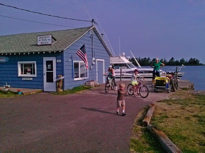
The next morning we biked into town. There is a crushed stone bike path that runs along US 41 from Fort Wilkins State Park to the east end of Copper Harbor. Our first stop was at Jamesen’s Fish Market for donuts and coffee.
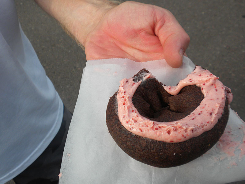
The homemade donuts with the thimbleberry frosting were awesome! Thanks to one of the visitors of our site for recommending this to us. If it was not for his email we may have overlooked this great little place. The smoked fish is also very good.
Our plan was to sit outside at the picnic tables outside Jameson’s and enjoy our coffee and the view of Copper Harbor. However, we had a 2 year old with us that wanted to either run into the parking lot or fall off the dock into the water. We decided it would be best to finish the rest of our coffee on the go.
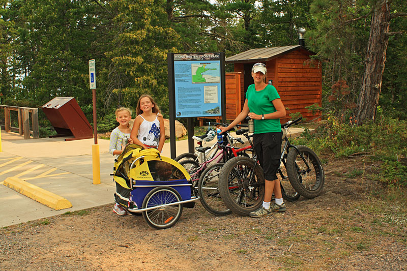
After our donut stop we continued on to Hunter’s Point. There is another crushed stone bike path that starts on the west end of town by the entrance to the marina and goes out to Hunter’s Point Park. This is also the same path that takes you back into town at the end of The Flow trail.
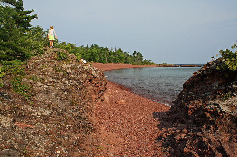
The kids have always liked climbing on the rocks along the shore here.
Walking on the red rocks to the west end of Hunter’s Point Park.
Another good spot for throwing rocks.
Biking back from Hunters Point on North Coast Road.
More information on Hunter’s Point Park >>
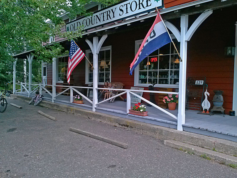
On the way back we made one more stop at the Old Country Store so the girls could try and spend some of their souvenir money. The only purchase ended up being rock candy that they ate on the porch.
Copper Harbor Mountain Biking – On The Edge Loop
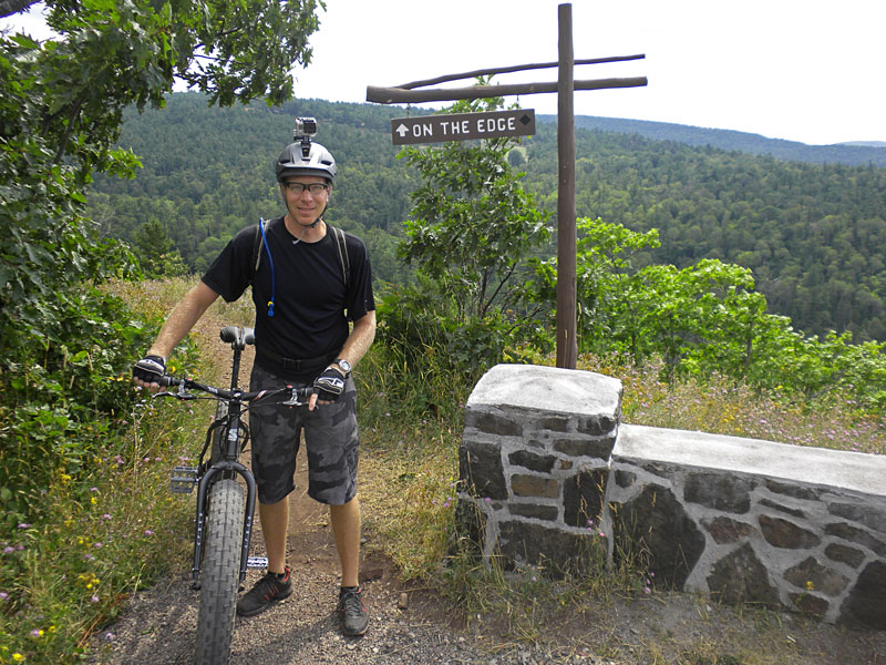
In the afternoon it was time to hit the mountain bike trails again. I was dropped off up on Brockway Mountain again, but this time I went down the other side via the On The Edge Trail. From here I explored some more of the west trails and then crossed US 41 by the Keweenaw Mountain Lodge. From here I worked my through some more of the east trails back down into town.
The On The Edge trail is only 0.4 miles long, but it may be the most interesting 0.4 miles of single track in Michigan. It starts running right along the edge of a cliff and then drops down Brockway Mountain on a section of wooden bridge switchbacks.
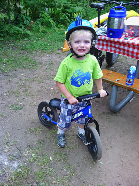
When I got back Reid had to show me the rocky trail that he found along Lake Fanny Hooe in the campground. He is wondering when they are going to start making the full suspension version of the Strider Balance Bike. He is getting so fast that we either have to run or ride our bikes to keep up with him.
In the evening we took a relaxing drive to Eagle Harbor.
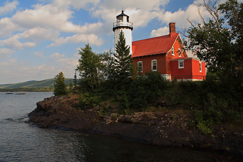
The Eagle Harbor Lighthouse.
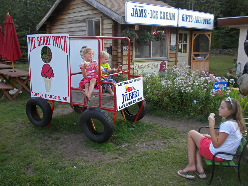
Back in Cooper Harbor we stopped at the Berry Patch for ice cream.
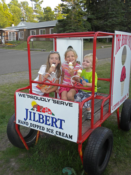
The only thing that the girls remember from our last visit was this play car at the Berry Patch.
Hunters Point Trail:
The next morning we drove back to Hunter’s Point to walk the trail out to the end of the peninsula. We started out on the South Beach Trail that runs along the shore on the Copper Harbor side of the point. There were several openings where you can walk down to the rocky shore for a view of the Harbor.
In just over 0.5 miles you reach the end of the point.
This is a another great place to climb around on the rocky shore.
Looking back along the north shore of Hunter’s Point.
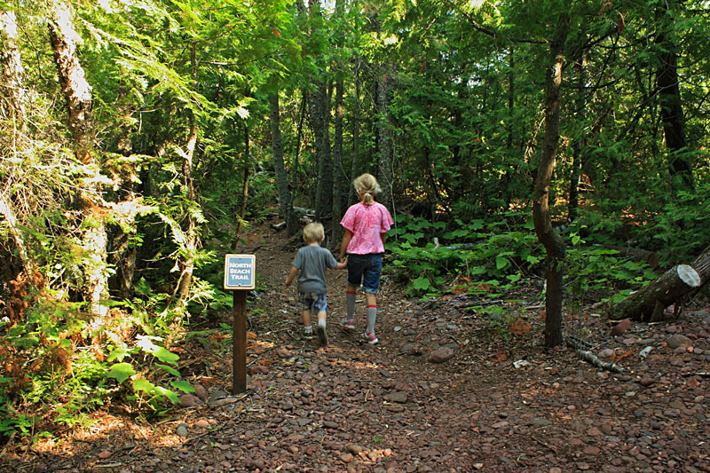
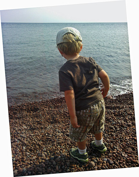
We let Reid get out of the Kelty Backpack Carrier and walk the 0.6 miles back to the parking area on the North Beach Trail.
See our Michigan Hikes page for more photos from this hike >>
View Hunters Point 8/20/2013 10:37am in a larger map
The North and South Beach Trails make a figure 8 loop that is a 1.2 mile hike. The trail is all rocks and roots so you will want decent shoes, but with little change in elevation it is a hike that kids of all ages should be able to handle. The round trip took us about 50 minutes to complete with several stops along way to check out the rock formations.

For more on this hike see: Hiking Michigan – 2nd Edition (America’s Best Day Hiking Series)
Esrey Park, The Jampot and The Great Sand Bay Beach:
From Hunter’s Point we continued west on M26. Our next stop was at Esrey Park for lunch. With picnic table right on the edge of the rocky Lake Superior shore this is one of our favorite roadside parks in Michigan.
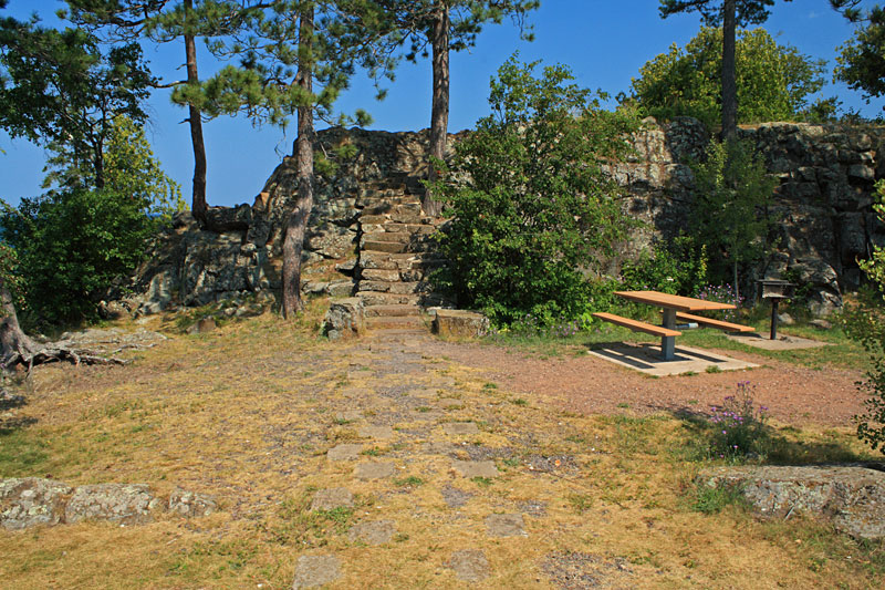
Another unique feature of Esrey Park is the steps cut into the rock wall that lead up to a nice overlook.
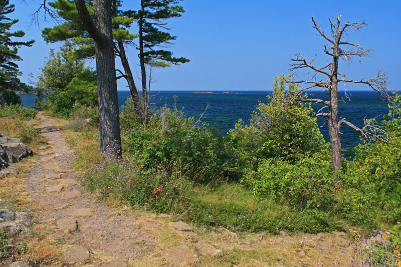
The view from the top of the wall. There are no handrails here so we had to keep reminding the kids to be careful and not get too close to the edge.
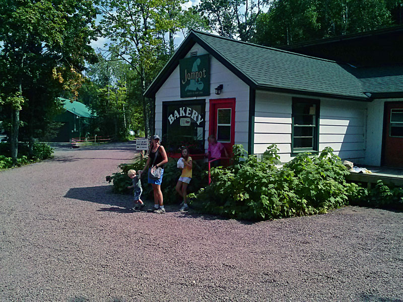
After our picnic we continued through Eagle Harbor and on to the Jampot. The Jampot is operated by the brothers of the Society of St. John, a Catholic Monastery. They make tasty homemade jams. jellies and baked goods. After waiting in a short line we left with some Wild Thimbleberry Jam and a couple huge muffins. All of it was very good, if you are up here make sure to try some for yourself.
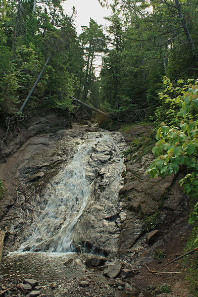
Just up the road a couple hundred feet is Jacob’s Falls. This 20 foot high cascade is right on the edge of the road and is worth making the short walk over from the Jampot to see.
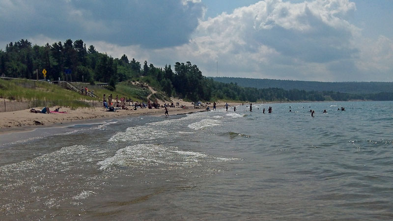
After the Jampot we headed back towards Eagle Harbor and stopped at one of the beach access spots on the Great Sand Bay. We spent the rest of the afternoon swimming and relaxing. The area was a little busy for the UP, but the beach was nice and the water was warm with a shallow sandy bottom. There are several access spots along this section of road. We chose this one because it had the shortest stairs and a parking area across the road with pit toilets. Everyone else must have been thinking the same thing.
Directions to the Great Sand Bay Beach >>
At night we drove up to the Keweenaw Mountain Lodge for dinner. We have eaten here a couple times and it is one of our favorite places in the area. It has always been very good, but never very busy. This hopefully is not a bad sign and it is just because we usually eat fairly early in the evening.
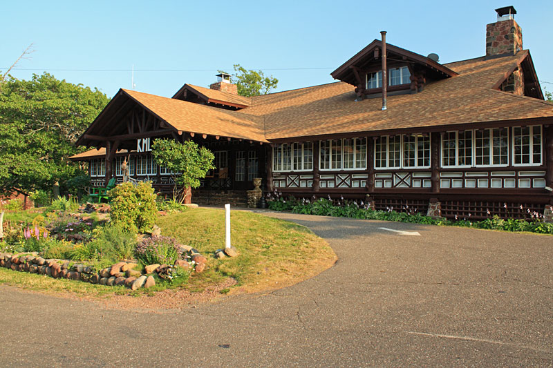
The historic lodge was built in 1934 from hand hewn logs. The building has a lot of character both inside and out, and feels like you are stepping back in time. In addition to the restaurant there is a 9 hole golf course and the mountain bike and hiking trails run right though the property. For overnight accommodations there are 8 motel room and 24 cabins with 1 to 3 bedrooms.
More information on the Keweenaw Mountain Lodge >>
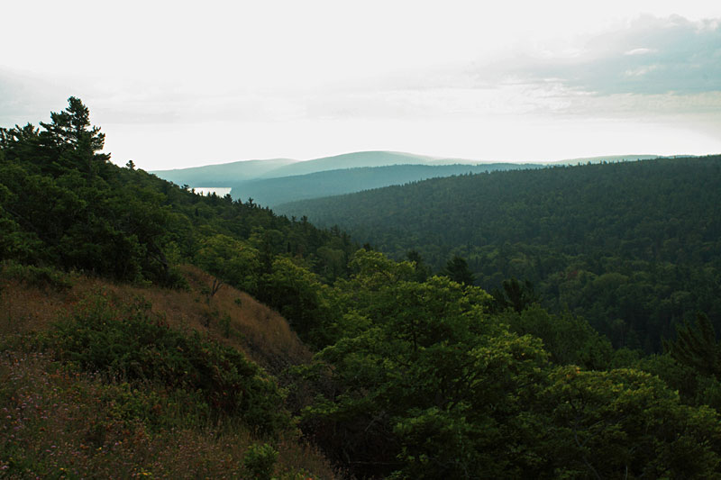
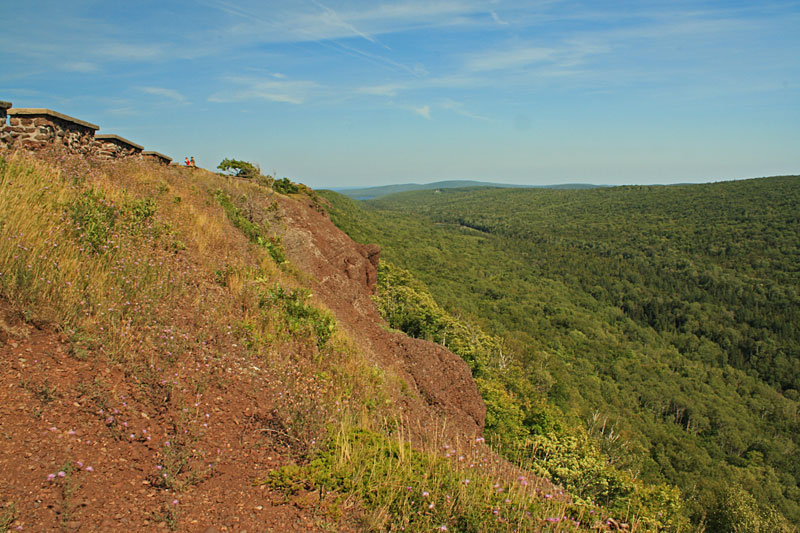
Hazy morning up on Brockway Mountain.
The next day was our last full day up in Copper Harbor. The family shuttled me up Brockway Mountain for one more ride down the flow trail and then met me in town for another thimbleberry donut. After the donut stop I rode some more of the trails on the east side of US 41. At the end I decided to try and take the Downtown trail back to town. This ended being the most difficult trail that I rode up here. There were several sections that were not rideable, at least for an old guy on a fat bike.
We spent the rest of the day at the campground resting and preparing for our departure. The first order of business was laundry. There is a laundry mat available in the bathhouse in the east campground.
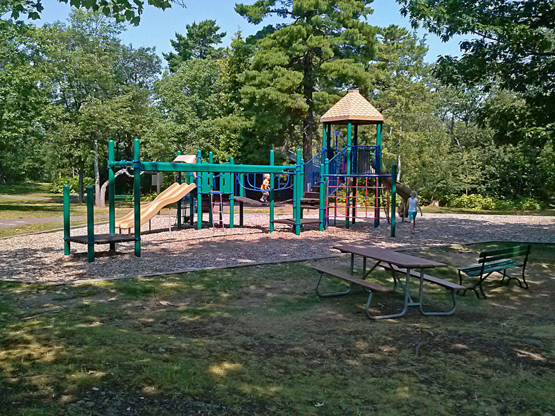
While waiting for the laundry we walked over to the playground between the campground and the parking lot for the fort. When the kids were playing a bald eagle flew right over us on the warm breeze. It was kind of funny that after all the hiking and biking that we did, we finally see our first eagle right in the campground.

Next we tried fishing in Lake Fanny Hooe. The fishing dock is located next to the boat launch on the end of the west campground.
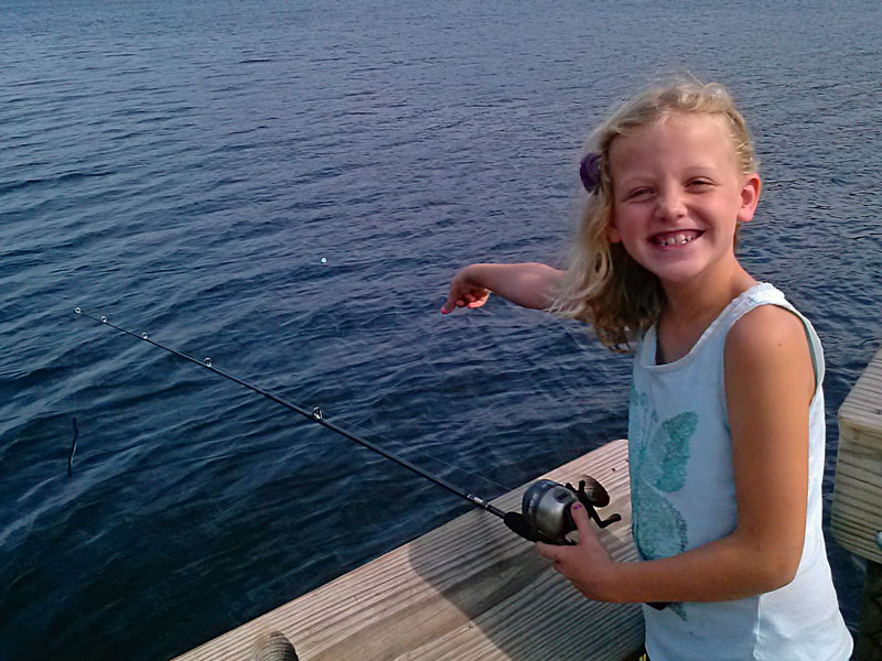
Reesey tried so hard to blow a bubble that the gum shot right our her mouth and into the water. We watched it float until the wind pushed it out of sight. We didn’t have any luck so the fishing did not last very long.
In the evening it was warm, humid and buggy at the campsite. We used this as a good excuse to go out to eat again. We planned to drive to Calumet and go to the historic Michigan House Cafe. Unfortunately when we got there we found out that they are closed on Wednesdays. There wasn’t anything else that looked good to us in Calumet. We probably should have just headed back to Copper Harbor, but instead I continued on to Houghton not really realizing how far the drive was.
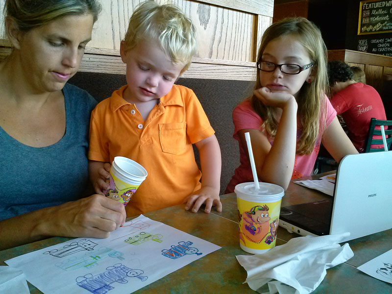
In Houghton we found The Library Restaurant and Brew Pub. The food ended up being pretty good, but we waited way too long for it. Mom had to keep Reid entertained by drawing trains and playing videos. When the food finally did come we almost had a mutiny on our hands because the kids meals did not come with fries. Apparently you need to add them and they are extra. Another big minus for this place. Luckily we had some to share and the crisis was avoided.
When we got back to the campsite mom broke out the super s’ mores to make up for the disappointing dinning experience. In the morning it was time to leave Copper Harbor and start making our way back towards home. We broke up the long trip back with stops at Pete’s Lake and Cheboygan State Park. Follow the link below for the rest of our trip.
Continue along with us to our next stop at Pete’s Lake Campground near Munising, MI >>
![]()
![]()
![]()
![]()
![]()

I am often asked about the camera that I use for the photos on this site. We are starting to use our cells phone cameras more because of the convenience and improved quality. However, when I want to good quality photo it is still hard to beat my old Cannon DSLR camera.
I have been using a relatively inexpensive Canon Rebel XS with the 18-55mm lens for several years now. This trusty old camera only has a 10MP sensor, but the photos still look better than our 16MP point-and-shoot. For outdoor shots I often use a Circular Polarizer Filter to reduce glare and to make the sky and other colors really pop.
Search for Canon DSLR Cameras on Amazon >>
Advertising Disclosure: We may receive a commission if you click a link on our site and purchase one of the products or services that we recommend.