Visiting Marquette, Michigan on the first stop of our Western U.P. trip. – August 10 – 13, 2012
For our trip to Michigan’s Upper Peninsula this year we camped at 3 different places. First we spent 3 nights in Marquette at the Tourist Park Campground. Then we continued on to Porcupine Mountains Wilderness State Park for 5 nights. On the way back home we spent a couple relaxing days at a beach side site in the Bay Furnace Campground in Christmas, Michigan.
We have posted 5 separate pages of pictures from this trip so make sure to look for the links to the next page at the bottom of each entry.
For this trip we decided to leave on Thursday night after work and drive just across the bridge to the Straits State Park. We reserved a pull through site right across from the bathhouse. It worked out really good, we pretty much pulled in and climbed right into our bunks in the camper without even unhooking from the truck. In the morning we had a quick breakfast, showers and it was back on the road again to Marquette.
Camping at the Marquette Tourist Park:
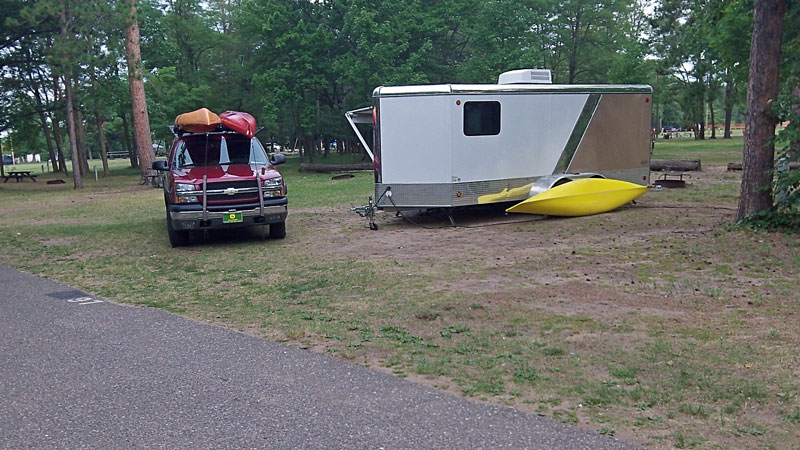
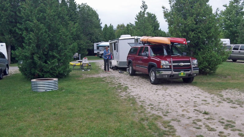
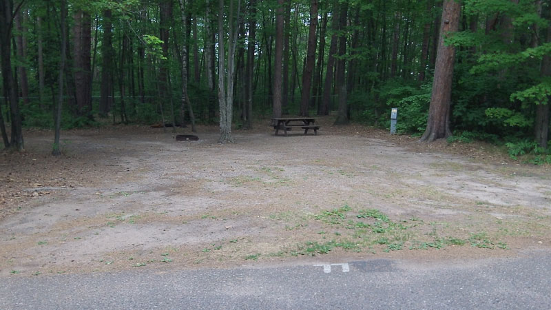
In Marquette we stayed at site #97 in the Tourist Park Campground. We could not find much information about this campground and were not really sure what to expect. The campground sits on about 20 acres on the North edge of town. There are 110 total campsites, 38 with full hook-ups, 62 site have just electric and the remaining 10 sites are for tent camping. Most of the sites were shaded by big pine trees, but had little privacy.
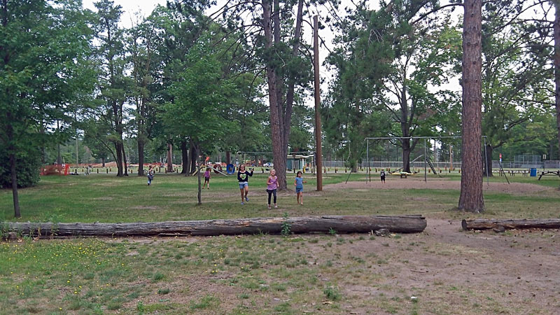
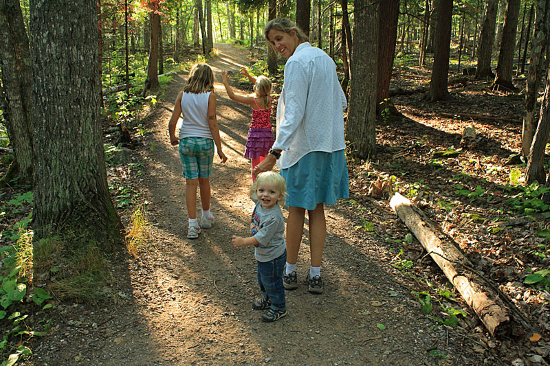
Right behind our site was an older playground with swings and a couple slides and beyond that a baseball field. We thought staying near the playground was a good idea until every morning when Reid stepped out of the camper he made a run for the slide. We took turns watching him do laps up and down. It felt like most of our stay was spent standing next to the little slide.

Looking down the road from our site towards the bathhouse. We just happened to be staying here on the weekend of the Ore to Shore Mountain Bike Race. Even with the campground filled to capacity on Friday and Saturday nights with bikers, the campground staff did an excellent job keeping the facilities in order.
When Reid wasn’t on the slide he was exploring the campground on his bike.
Sites #77 and #78 were a couple of the best sites tucked away pines at the end of the loop. Even though the campground is in the city limits it really didn’t feel like it. The sites on the south side of the loop backed up to an industrial area, but even these did not seem too bad.
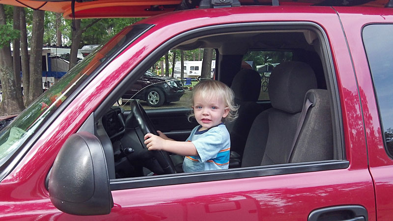
About the only way we could get anything done was to let Reid play in the truck. Because of this we are now those people at the campground who’s car alarm keeps going off.
Overall we enjoyed our stay at the Tourist Park and will be back again.
For more info and Tourist Park reservations click here >>
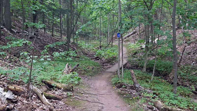
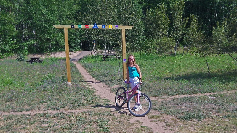
Mountain Biking the Mount Marquette Trail – Blue Loop:

After eating lunch and setting up camp I decided to sample some Marquette mountain biking while Reid took a nap and the girls played at the campgrounds. Marquette has an awesome trail system thanks to the work of the Noquemanon Trail Network. The Mount Marquette or Blue Loop is advertised as some of the best single track in the area, so that is where I headed. This trail definitely did not disappoint.
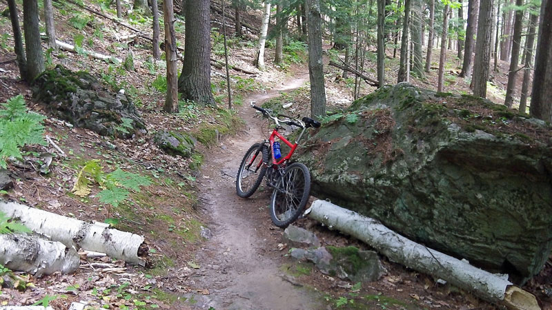
After just a little riding I realized that I was no longer in West Michigan when all the rocks and roots were making my tires almost bottom out on the rims. I stopped and added some air and was good to go for the rest of the ride.
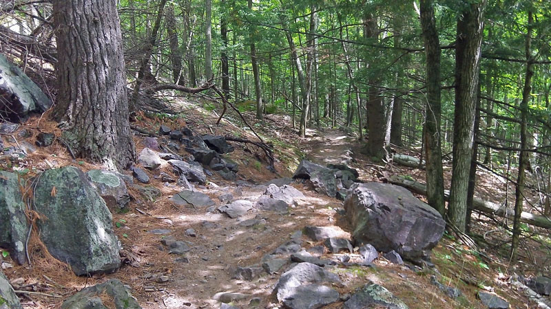
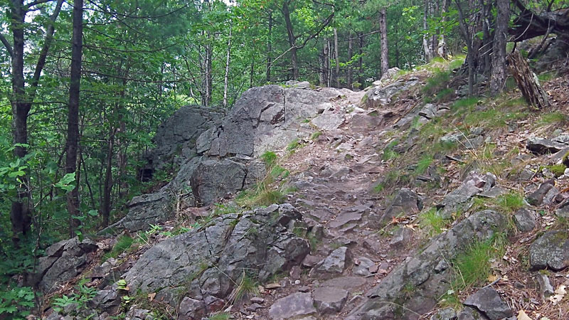
A fairly common rocky section of trail.
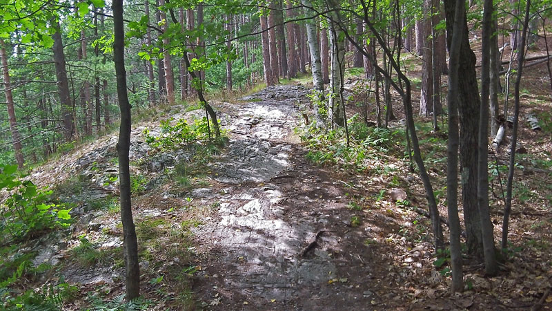
A fun downhill.
The bridges on the “Up the Creek” section of the Mount Marquette Loop.
Rolling single track near the end of the loop.
The Gurley Trail section. When there is a fork in the trail and the choice is easy to the right or most difficult left, of course you go left. I ended up walking the bike down this part…10 years ago I would have went for it without even thinking about it. I still am not sure if getting older and maybe a little wiser is a good thing. From this hike-a-bike section it is just a short ride back to the trailhead.
The Mount Marquette Loop is a 3.8 mile ride of Intermediate to Advanced single track. There is a good amount of climbing making for moderately strenuous ride. After this loop I took a quick ride on the Grom Kid’s loop to cool down and see if it would be good for the girls to try. See page 2 for the report on this trail.
Marquette South Trailhead Directions >>
Mount Marquette Loop Trail Description on Noquemanon Trail Network Site>>
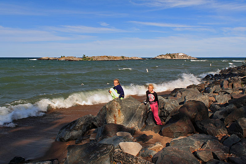
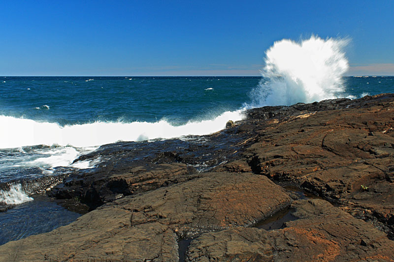
After dinner we went for a drive along the Marquette lake front. We stopped at Picnic Rocks Park to watch the waves rolling into the rocks.
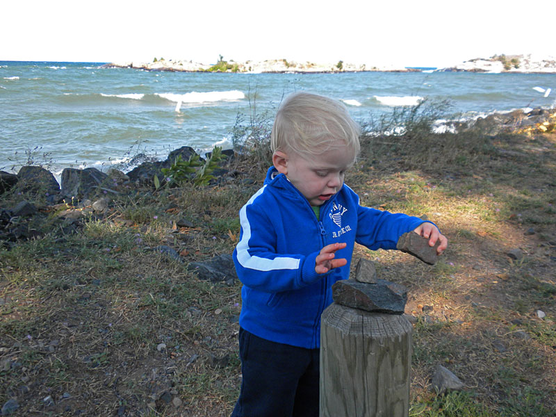
Reid had to stack rocks on every post along the parking lot.
From Picnic Rocks we drove north to Presque Isle Park and again watched the waves crash into the black rocks.
Hiking from Little Presque Isle Point to Wetmore Landing:

The next morning was sunny and still breezy. We drove north about 3 miles up to the Little Presque Isle tract. We planned to hike the 1.8 mile North Country Trail section along Lake Superior from Little Presque Isle Point to Wetmore Landing. On the way we dropped off my bike in the Wetmore Landing parking area so I could retrieve the truck at the end of the point to point hike.
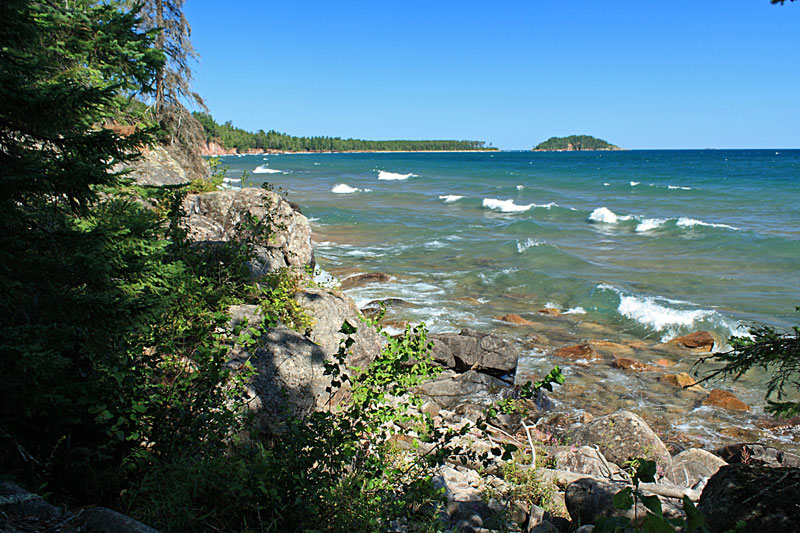
The picture above is looking out from the point to Little Presque Isle. It was interesting to watch the waves wrapping around the island and colliding with each other.
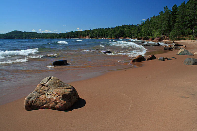
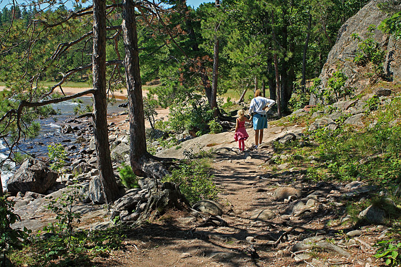
For about the first 1/4 mile we dropped down from the trail and walked the sandy boulder filled beach.
When the rocks started we climbed back up to the trail.
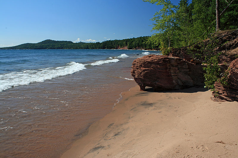
Looking back to Little Presque Isle as we started to climb higher on red rock cliffs.
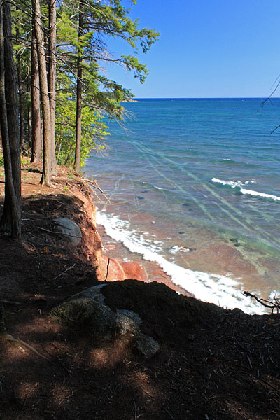
Looking down at the interesting lines on the bottom beneath the crystal clear Lake Superior water.
Mom had the great idea of telling Reid that the blue trail blazes were “Blue’s Clues.” Between this and pop pops (lollipops for those that do not speak baby) he stayed happy for the rest of the hike.

At about 1 mile into the hike stairs take you up above the highest cliffs along the lake.
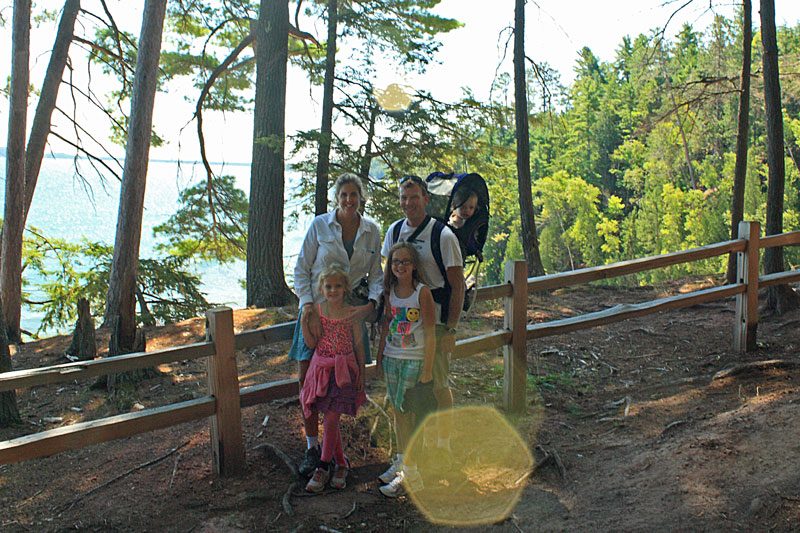
A nice family offered to take our picture from the lookout…to bad we had the sun right at our backs.
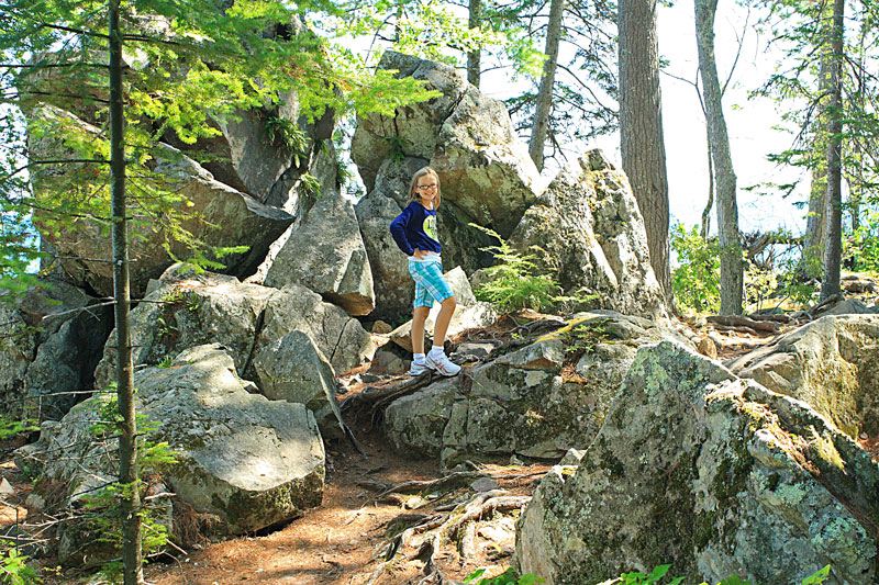
The trail took us through some interesting boulder fields after dropping back down along the shore.
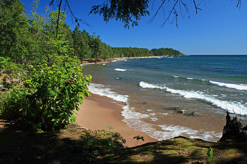
Looking back along the shore to Little Presque Isle.
Nearing the sandy beach at Wetmore Landing.

For More on this hike and others in the area see: Hiking Michigan – 2nd Edition (America’s Best Day Hiking Series)
Directions to Little Presque Isle trailhead >> | Directions to Wetmore Landing >>
Presque Isle Park, Marquette:
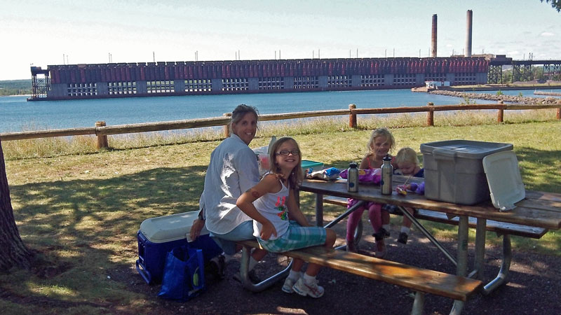
After our hike we stopped at the big Presque Isle Park and ate lunch overlooking the working ore dock. Presque Isle Park is a 320 acre peninsula on the north edge of Marquette. The park has 2 picnic areas, restrooms, a playground and even an ice cream concession. There is a nice single lane scenic drive along the outside of the island with pull offs where you can view the red rock cliffs and explore the rocky Lake Superior shoreline. There are also several hiking trails through the wooded interior of the park that we did not get a chance to explore on this visit.
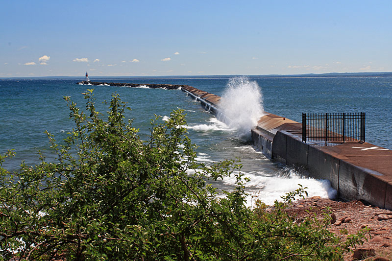
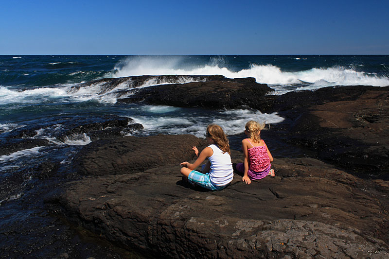
It was still pretty windy and everyone was stopping to watch the was hit the break wall near the picnic area.
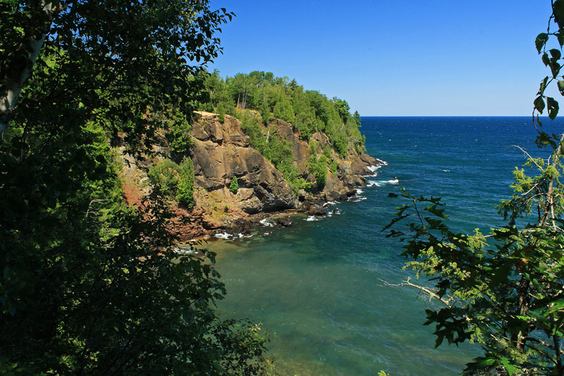
The red rock cliff overlook on the west side of the park.
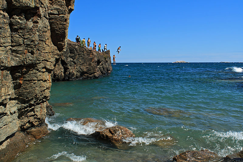
The black rocks area at the tip of the park is popular cliff jumping spot. Next time we have to try it.
The black rocks area is also a fun place for the kids to climb around on the rocks.
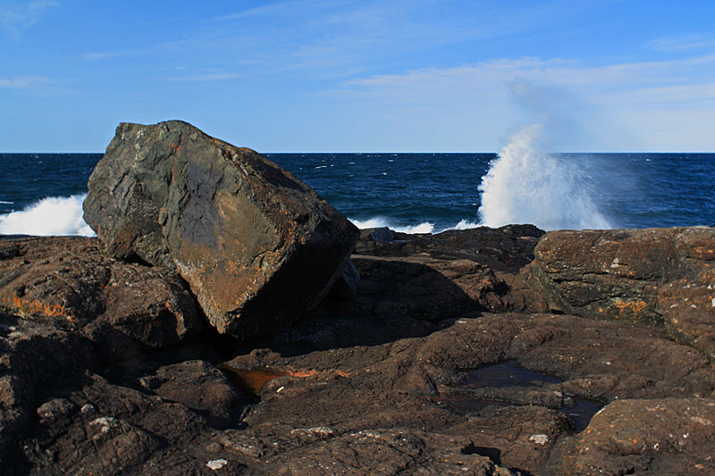
Watching the waves rolling into the black rocks. For More Information on Marquette’s Presque Isle Park Click Here >>
Climbing Sugarloaf Mountain:
Everyone’s legs were tired from our morning hike along Lake Superior, but after dinner we decided to try the short climb to the top of Sugarloaf Mountain. From the parking lot there are 2 routes to choose from. We took the easy route to the right which loops around the side of the Sugarloaf Mountain on the way to the top. The more difficult route looked a little too steep and rocky for the kids.
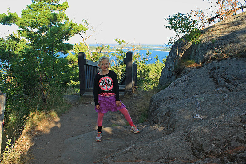
Reesey happy to be at the top. As you can see we let them choose their own clothes when we are camping. Thanks Grandma and Justice.
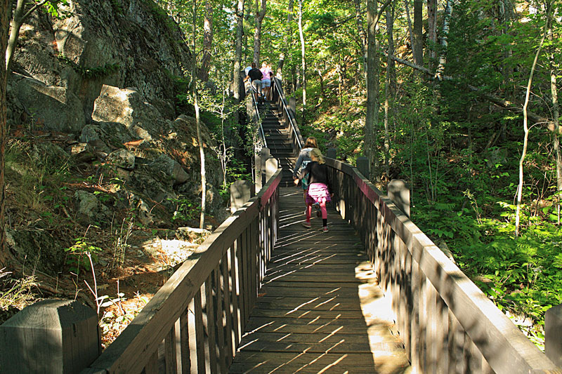
The easy route is just over a 1/2 mile long with several sections of wooden stairs. The kids counted 305 steps on the way to the top.
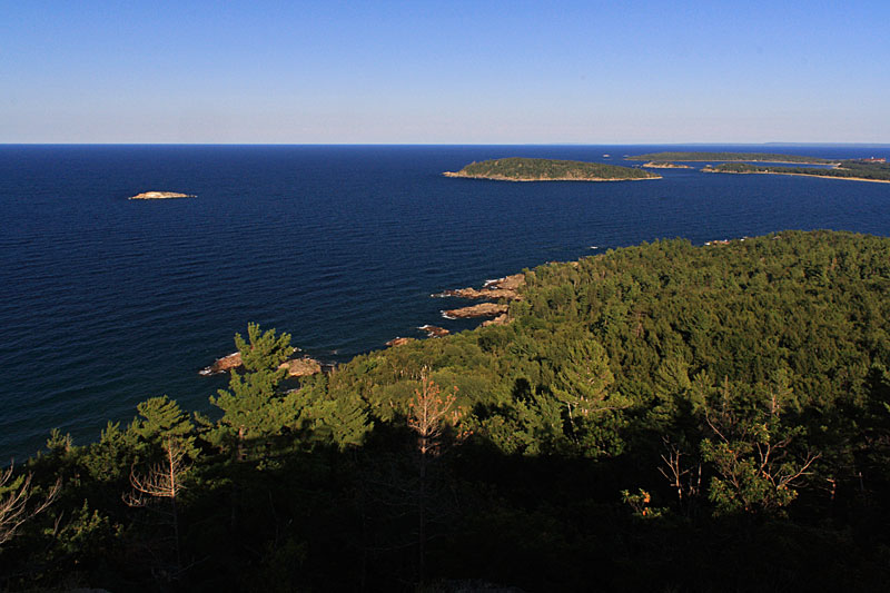
The rocky summit of Sugarloaf Mountain is about 470 feet above Lake Superior.
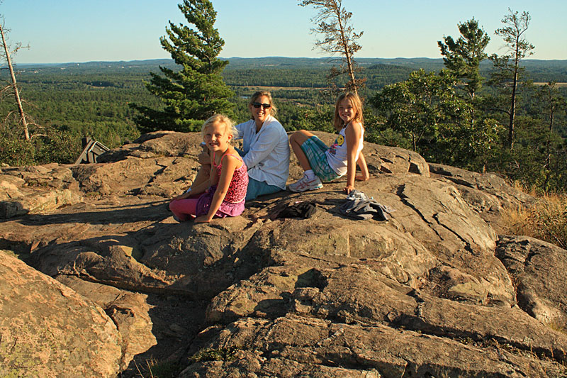
Resting on the warm rocks and enjoying the panoramic view of the rugged Lake Superior shoreline.
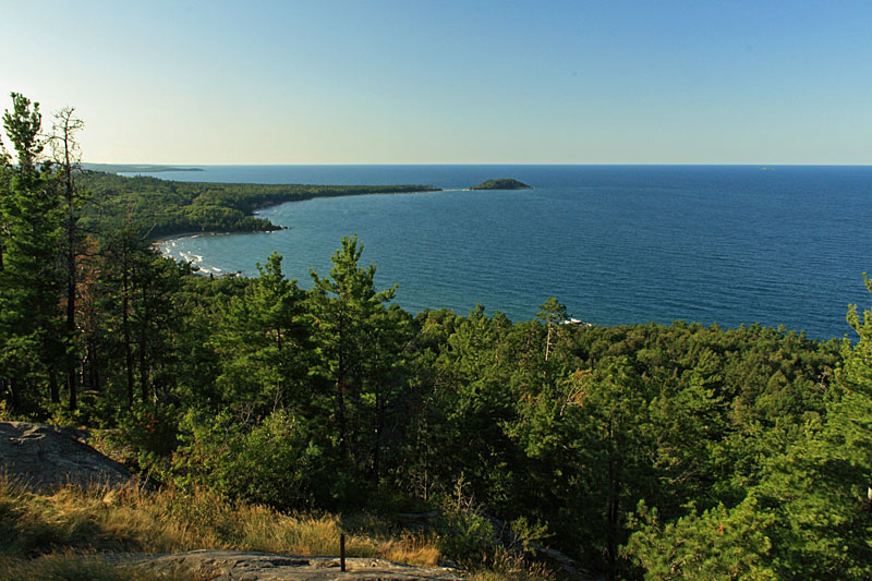
Looking north along the shoreline to Little Presque Isle. This is the same section that we hiked earlier in the day.

For more info on this hike see: Best Hikes with Children in Michigan
Directions to the Sugarloaf Mountain trailhead >>
Kayaking from Picnic Rocks Park to the Marquette Lighthouse:
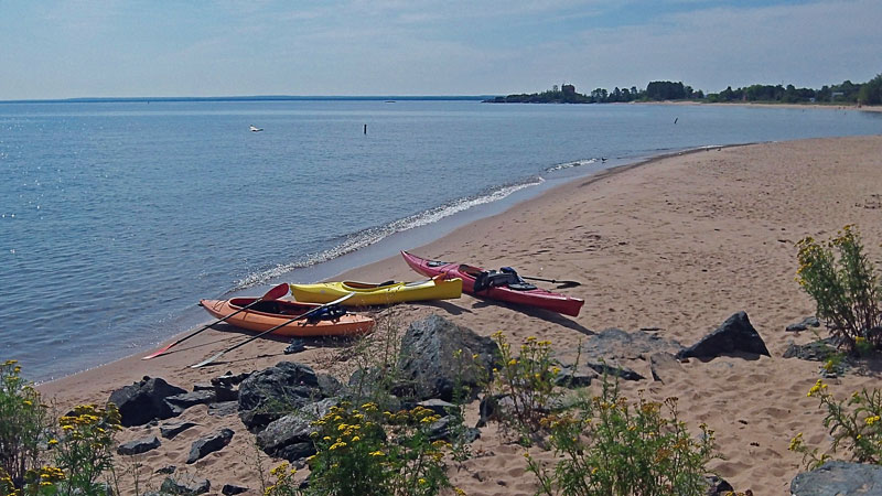
After two windy days Sunday morning was finally calm and sunny. We loaded up the kayaks and headed down to Picnic Rocks park to paddle along the shore to the Marquette Lighthouse.
Loaded up and launching with the Picnic Rocks in the background.
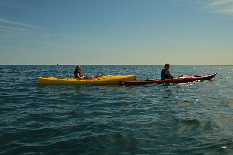
The girls floating on the beautiful blue Lake Superior water.
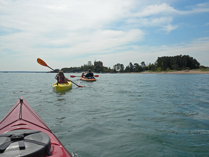
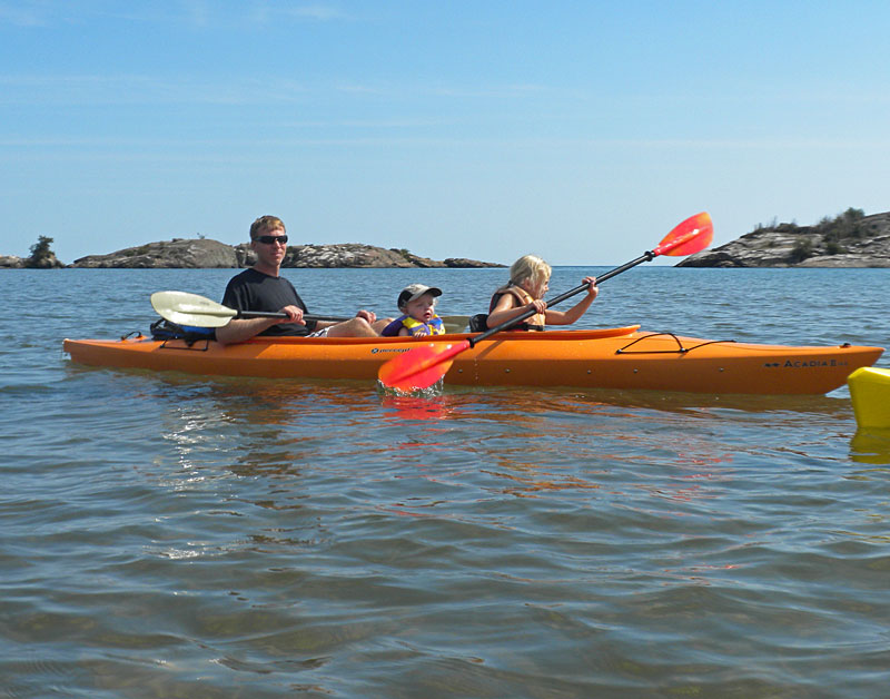
Our fleet approaching the Marquette Lighthouse.
It is an easy 3/4 of a mile paddle from Picnic Rocks to the lighthouse. Almost the entire way the shore is soft sand. This would also make for a nice beach walk. Really the only hazards for paddlers in this area are the rocks around the lighthouse. On our previous visit it looked like the currents between the Picnic Rock islands and shore could also make for some interesting paddling when the wind picks up from the north.
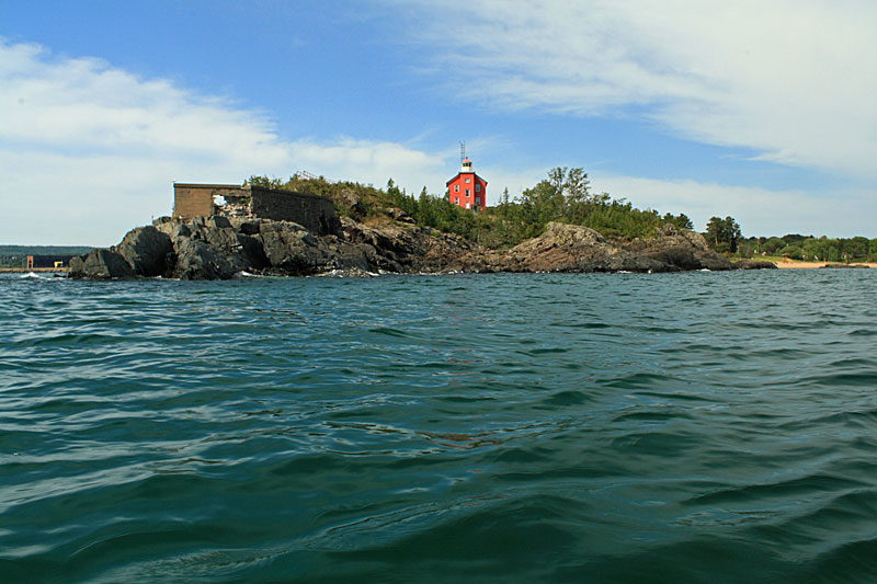
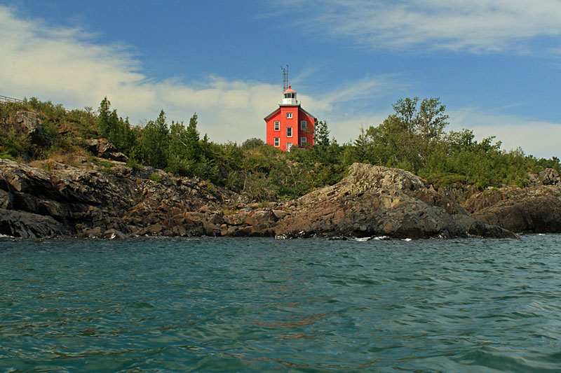
The red lighthouse sits on a small rock peninsula jutting out into Lake Superior.
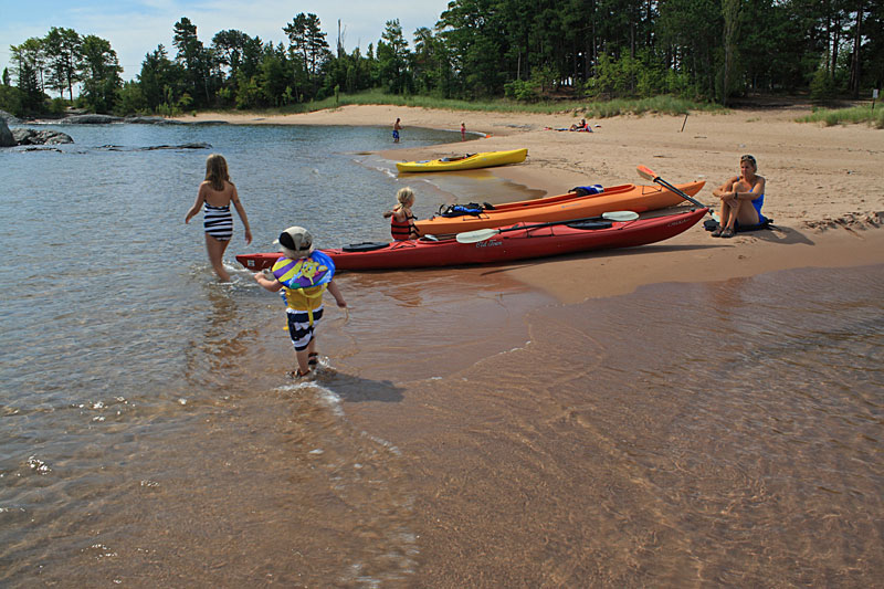
After exploring the rocks around the lighthouse we pulled the kayaks up on the beach in McCarty Cove and let the kids play in the water.
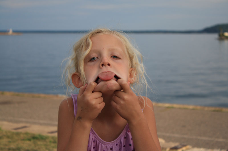
Reesey was a little surprised by how cold the water was.
After paddling back we were ready for lunch. We found it a little strange that “Picnic” Rocks Park did not have any picnic tables. So sat and ate our sandwiches on the tailgate of the truck. There is still nothing better than waterfront dinning.


Both of the following two books have a lot more information on kayaking in the Marquette Area:
Guide to Sea Kayaking on Lakes Superior and Michigan: The Best Day Trips and Tours.
Paddling Michigan (Regional Paddling Series)
Directions to Picnic Rocks Park >>

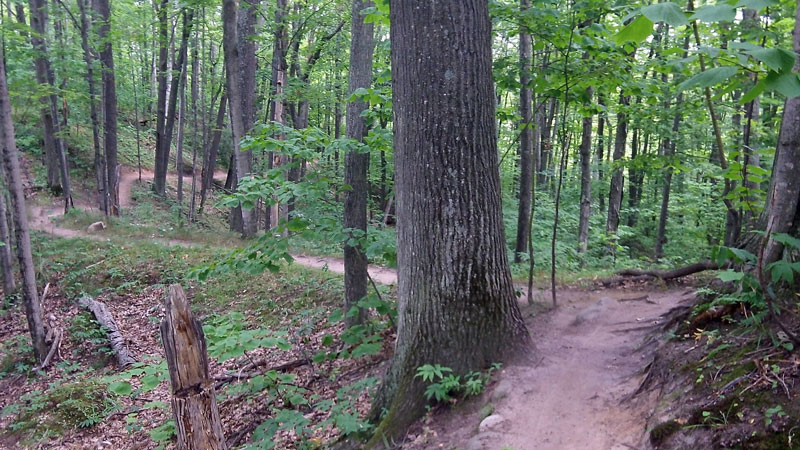
 The “Grom” Kids Mountain Bike Trail:
Mom decided to let the girls pack themselves for this trip. However, after the incident on Sugarloaf Mountain the previous night we realized that Reese only packed two underwear for the 9 day trip. Good thing our first stop was in Marquette which is one of the few places in the U. P. that has stores like Walmart and Target.
We planned to ride the Grom kids mountain bike trail in the afternoon, so Mom dropped us off at the south trailhead and went underwear shopping with her little buddy.
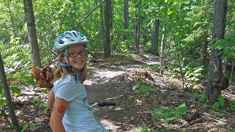
The Grom or purple trail is a 1.2 miles loop designed especially for kids and beginners. It looks like they put a lot of work into building this trail and it is really well done. The trail is smooth and free of all the rocks and roots that are common in this area. Do not be fooled by the beginner rating, this is a fun ride with small hills and flowing banked corners.
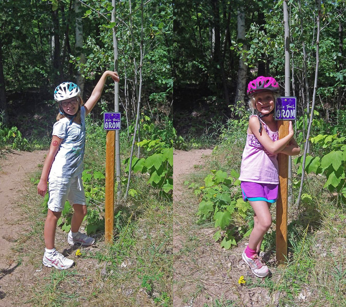
Taking a break to pose by the purple trail marker.
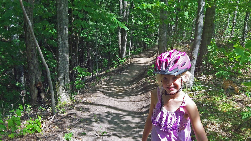
Most of the trail was wide enough that Reese and I didn’t have too much of a problem navigating the tag-along around the loop. The only problem we had was one minor toe smash.
The girls had such good time that we went for a 2nd lap and then played on the balance beam and teeter totter at the trailhead while we waited for Mom to pick us up. Regan made it on her first try, but then when the camera was rolling she got scared went a little too slow.
Marquette South Trailhead Directions >>
The Grom Trail Description on Noquemanon Trail Network Site>>
L’Attitude Cafe and Marquette Lower Harbor Park:
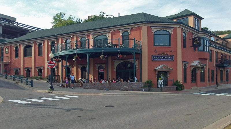
When we are in a new town looking for a place to eat we usually try to find an older historic restaurant. In Marquette this would be theVierling Restaurant. With the bike race in town we decided it would best to wait until Sunday night to go out. Unfortunately we found out that the Vierling was closed on Sunday, so we walked down the hill to the L’Attitude Cafe and Bistro.
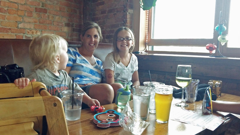
The L’Attitude ended up being very nice and the food and service was excellent. They have a patio with outdoor dinning, but after being outside for 3 days we decided to settle in to comfortable booth inside by a window with a view of the harbor.
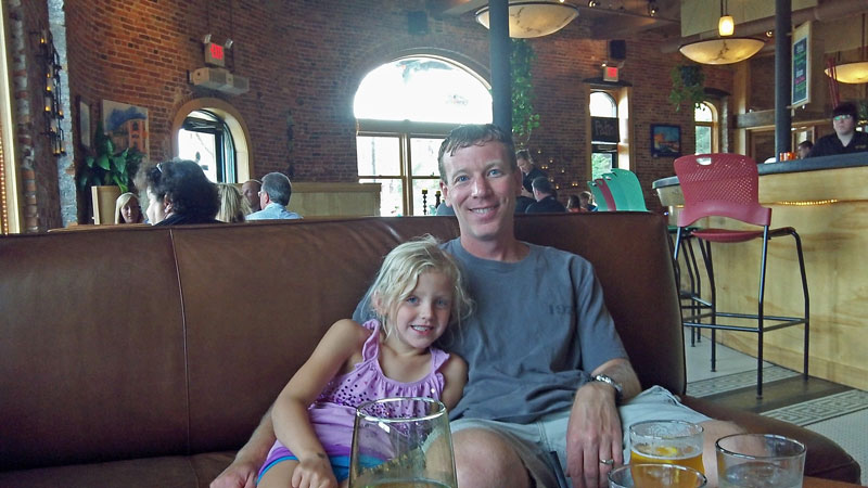
As you can see from the two photos above, the booths were actually big leather couches with a low wooden coffee table in between them. We were not sure how we would like eating like this, but it was actually not too bad and the kids thought it was great. With the brick interior and unique menu it felt more like we were dinning in a big city rather than Michigan’s Upper Peninsula.
Give L’Attitude Cafe a try next time you are in Marquette, for us it was a pleasant surprise.
L’Attitude Cafe and Bistro Website >>
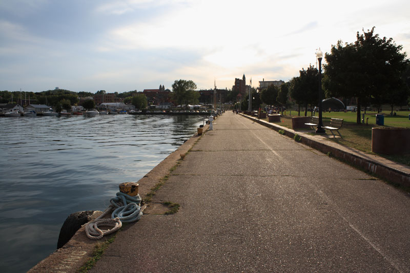
After dinner we walked across the street and down along the water.
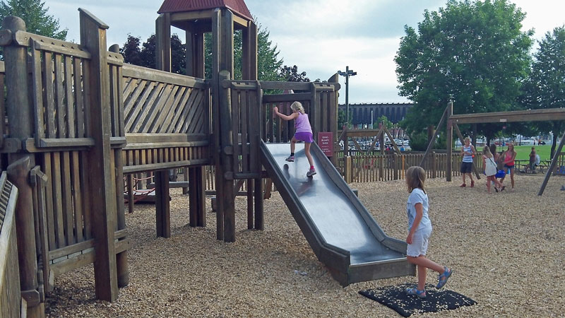
Down the on waterfront is Ellwood A. Mattson Lower Harbor Park. The park has a big open grass area with picnic tables and benches and of course a huge wooden play ground.

Next to the playground was a building with restrooms and an ice cream concession.
The lower harbor seemed like the place to be on Sunday nights. People were throwing around footballs and frisbees, kids were jumping in off from the breakwall and a band was setting up on the outdoor stage. As we were leaving even more people were rolling in carrying lawn chairs and six-packs. Too bad we had to get back to the campground and prepare for our morning departure to the Porcupine Mountains.
Continue along with us on this trip and our next stop at Canyon Falls >>
![]()
![]()
![]()
![]()
![]()

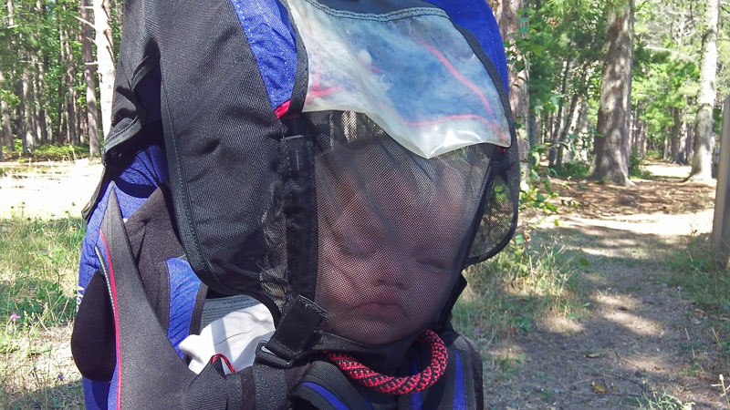
If you are going to be outside hiking with children under 3 years old a good backpack carrier is a must. We started with a cheap off brand carrier, but quickly realized we needed to upgrade to the Kelty. The adjustable hip belt on the Kelty was the only one we found that was long enough for taller people. The integrated sun shade and side screen also helps keep the bugs off your little hiker.
Search for Kelty Child Carriers on Amazon >>
Advertising Disclosure: We may receive a commission if you click a link on our site and purchase one of the products or services that we recommend.
Leave a Reply